I was recently made aware that to access the hikes I have shown on my blog and described in the “Hiking Loreto” guide book, requires permission from the ranch owners of the land.
You can contact the president of Loreto Guide Association, Rodolfo Palacios Castro, for a guide to take you on these hikes because they have permission from the owners and are aware of the need to protect these fragile places. His Facebook site is:
Currently, the owner of the Las Parras Ranch along the road to San Javier Church sells passes to their property at the Pescador Grocery Store or Hacienda Suites. As time goes by, there may be more owners who do this.
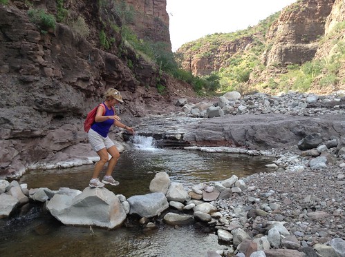
The hikes described below continue that activity. Gary and Heidi, who did the 5-day Kayak Tour with me, were on all of these hikes, plus they did a few more on their own.
The biggest difference this year is that we have lots of water in the arroyo hikes. With warm weather in November, we also have set up a tradition of swimming somewhere during our hikes. Very refreshing!
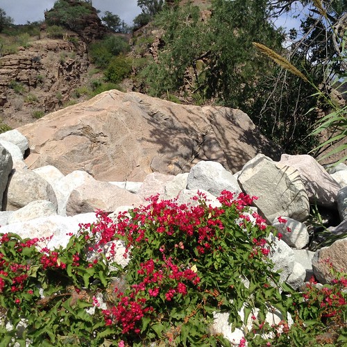
TABOR CANYON
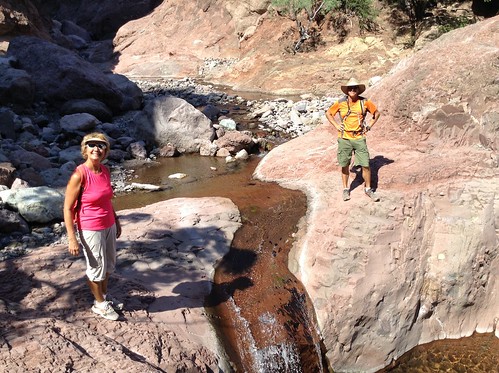
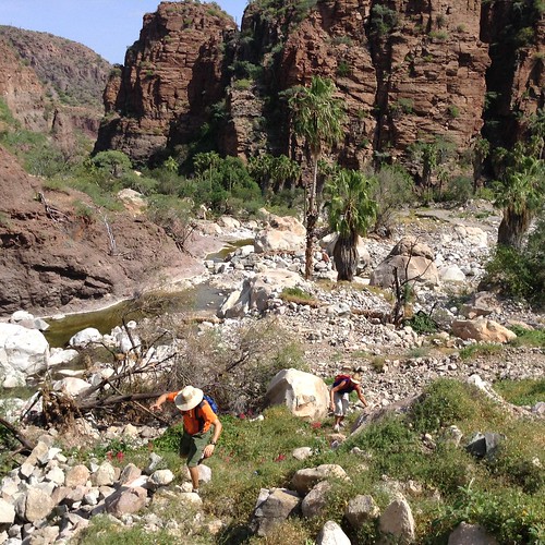
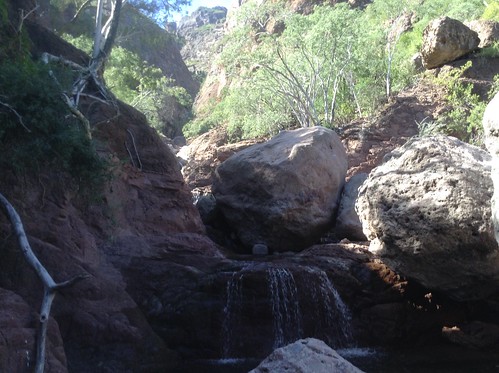
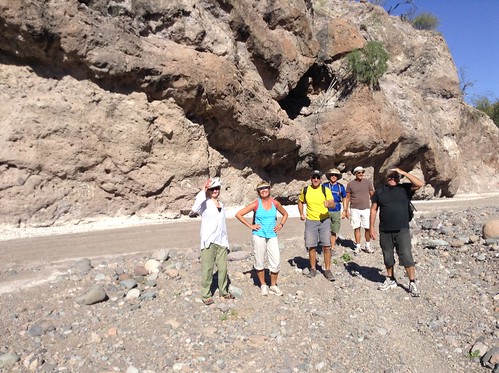
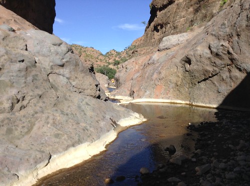
Our first day hike was to Tabor Canyon which was always unpredictable on what we would find following the hurricane seasons. We were not disappointed this time.
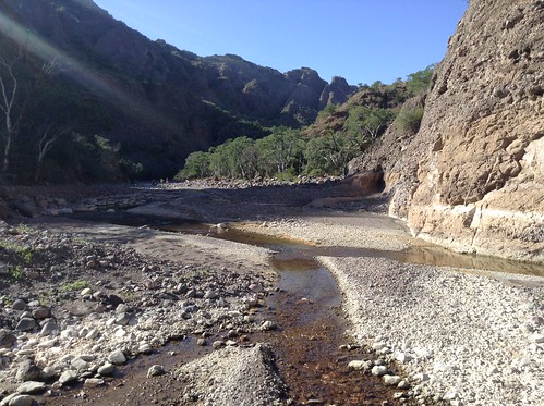
After meandering up the boulder-filled arroyo, we finally came to some water that trickled over a few rocks and disappeared into the river bed. A few hundred feet more and we began to come to lots of pools of water and soon we could no longer just jump across the widening river.


Heidi, Natalie, and Joseph are scrambling along the steep canyon walls just before the last waterfall we come to before turning around.

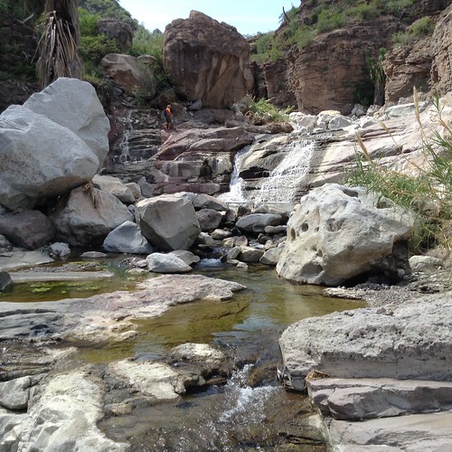
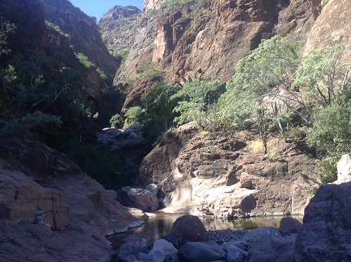
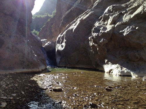
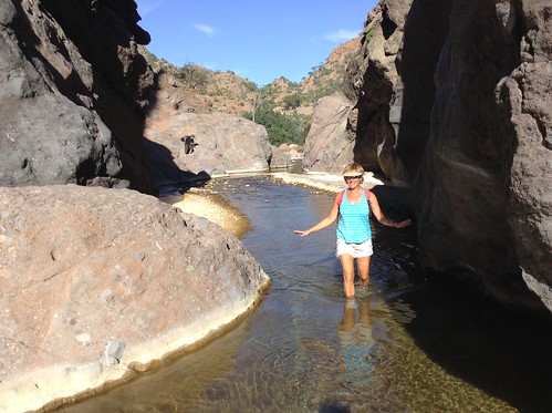
Finally, we could go no further since the wall we had to scale was steep, crumbly with a great exposure to damage of life or limb right where we came to the tallest waterfall.

Here is where we started our tradition of going swimming on all of our hikes. Very refreshing with a back massage thrown in.

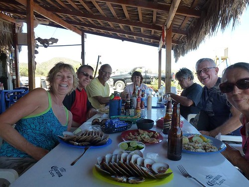
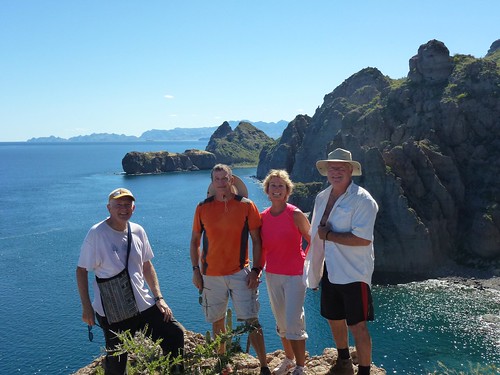
After most hikes, we pause for food and refreshments at the Clam Shack, Sabor!, or Del Boracho's. Here at the Clam Shack are Heidi, Gary, Joseph, Natalie, Jeff, me, Greta, and John's clams. A great way to end an enjoyable and challenging hike up Tabor Canyon.
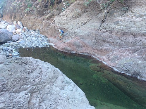
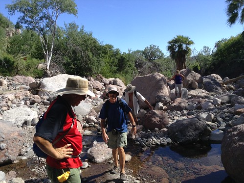
This hike begins about 14 km up the San Javier Road where it crosses a second Vado---a dip in the road where the water can flow over without causing damage. Before Hurricane Ivo buried the cave paintings under tons of gravel, we could view them. The river was running hub deep here as we parked the car and began hiking. After much boulder hopping, we came to some remnants of the old road, but it quickly disappeared in a jumble of boulders.
Heidi is leading us in some of the boulder hopping from one side of the river to the other.
We ended up doing a bit of bushwhacking trying to find the old road without success so we returned to the river and continued boulder hopping.
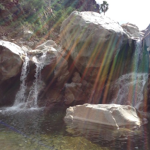
Once again we got to the end of the "easy" trail so we found a nearby swimming spot. where there were two waterfalls. entering a pool.
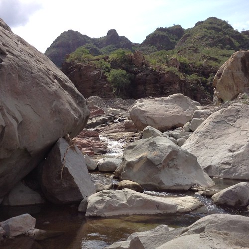
Boulders after boulders made this a challenging hike.
A lot of coral vines were blossoming along the way drawing the attention of us and clusters of yellow butterflies.
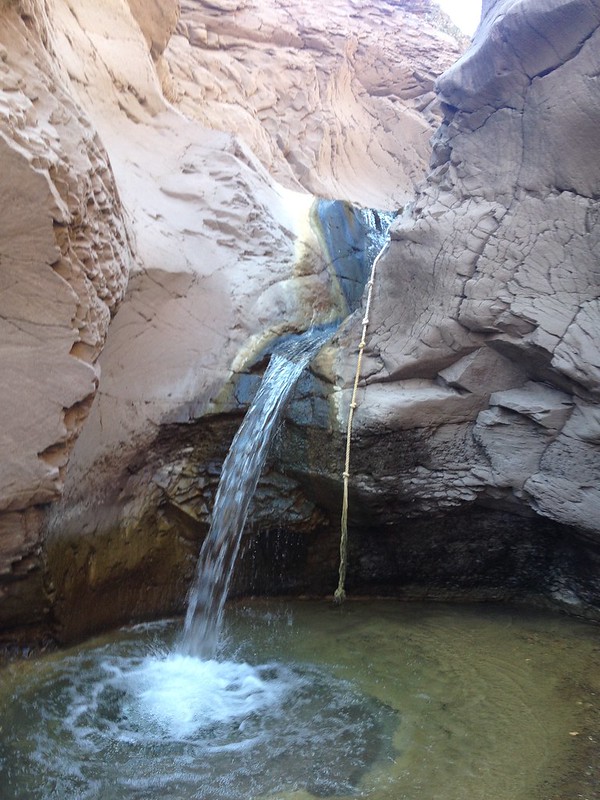
PREMIER AGUA---SLOT CANYON
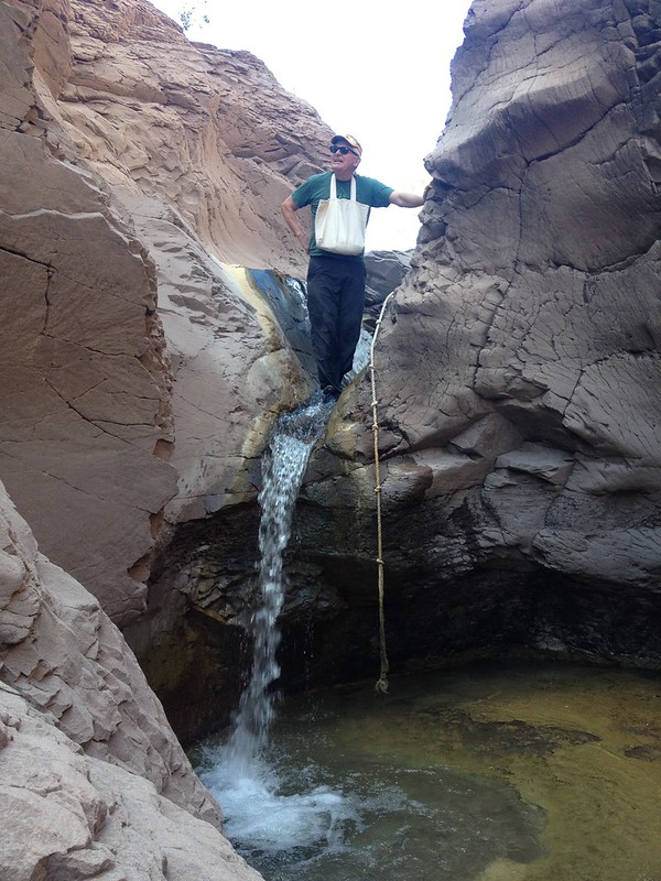
For this hiking area, the Oasis Premier Agua offers two directions for hikes--north toward the mountains or south toward the Sea of Cortez. We chose south to Slot Canyon which was a loop trail returning us back to our parked car, about a 3-mile hike. The "Hiking Loreto" book calls this easy, but I would term it moderate because of the waterfall climb using a fixed rope to scale the 10-foot waterfall or dry fall in drier times.
On the way to Slot Canyon, we crossed the river several times on our mile walk downriver. Compared to last year when Slot Canyon was dry, we immediately found ourselves wading through the water through this narrow and beautiful passage until we came to the waterfall with it's challenging rope climb.
I was the first to successfully scale this climb up the waterfall, getting very wet in the process.

JUNCALITO CANYON
It took us a bit of time to find the start of this hike, about .6 miles past the Juncalito road and just south of the electrical pylon by the wooden sign at the wired gate. We headed up the overgrown road until it drifted off to the dry Junacalito arroyo. Check out my weed-covered hiking shoes that look like I am wearing a pair of hedgehogs.


Once again, we reach a steep section of the canyon where we decide to turn back.

On many of our hikes, we come across these clusters of yellow butterflies.
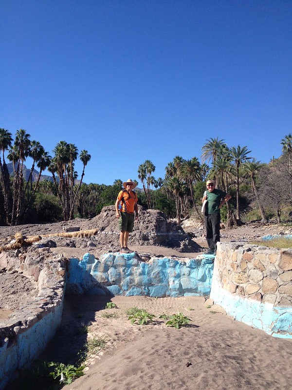
Villa Del Palmar Hiking Trails

To use these trails, you need to go to the front desk for a black bracelet that shows you are not a "real" guest since it is an "all-inclusive" resort. You can have meals here, but can only pay for them with credit cards. The trail begins on the east side of the beach. We headed up to the viewpoint, then hiked down to the beach for a swim, and finally up to the "Osprey Hike.
LIGUI CANYON
Instead of driving into the Villa del Palmar resort, we drove on the gravel road under the Highway 1 bridge. The "Hiking Loreto" guide indicated that you could drive up this arroyo for about 3.5 miles to a parking area. After 2 miles we could drive no further because the recent hurricanes had wiped out the road.
We began walking up the dry arroyo and occasionally saw tire tracks---rugged 4 WD car most likely--- and after about 1.5 miles the river occasionally began to surface. After another mile and a steady flow of the river, we finally came to the Ligui Canyon entrance filled with water.

After the swim, we then had to hike back down to our two 4 WDs and return to Loreto Bay.
There are still quite a few more hikes described in the "Hiking Loreto" guide book, but Tani and I will soon be leaving to return to Seattle for our first Thanksgiving and Christmas with our grandson, Atticus, along with his parents, Jessica--daughter--, and Joshua--son-in-law.
Here is a picture of Jessica with Atticus on their recent hike up Rattlesnake Ridge near North Bend, WA. It looks like he may enjoy hiking as much as his Mom and Granddad.
