I was recently made aware that to access the hikes I have shown on my blog and described in the “Hiking Loreto” guide book, requires permission from the ranch owners of the land.
You can contact the president of Loreto Guide Association, Rodolfo Palacios Castro, for a guide to take you on these hikes because they have permission from the owners and are aware of the need to protect these fragile places. His Facebook site is:
Currently, the owner of the Las Parras Ranch along the road to San Javier Church sells passes to their property at the Pescador Grocery Store or Hacienda Suites. As time goes by, there may be more owners who do this.
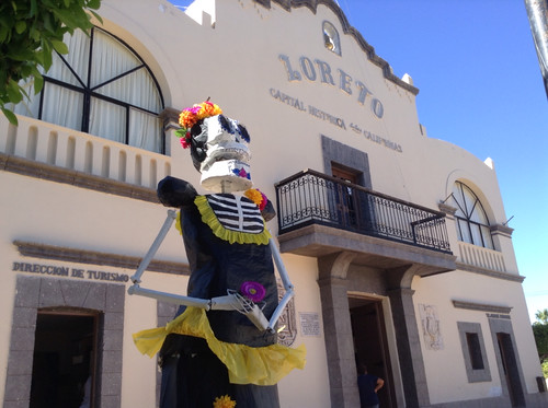
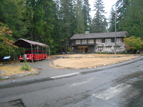
When it rains more and gets colder in the Pacific Northwest, I head to our place in Loreto, BCS, Mexico where I find myself leading and going on some amazing hikes up the many arroyos that pour out of the Sierra de la Gigante mountains and into the Sea of Cortez.
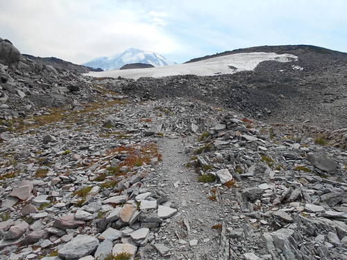
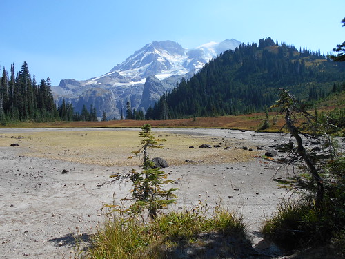
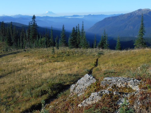
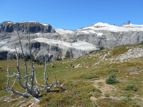
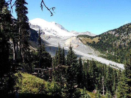
Future hike up Ligui Canyon. This was our turnaround spot.
This year, I began posting my hikes on the Villages of Loreto Bay Facebook site as well as the Loreto Bay Owners site which has increased the number of experienced and first-time hikers from just me on the first hike to 52 hikers recently.
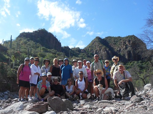
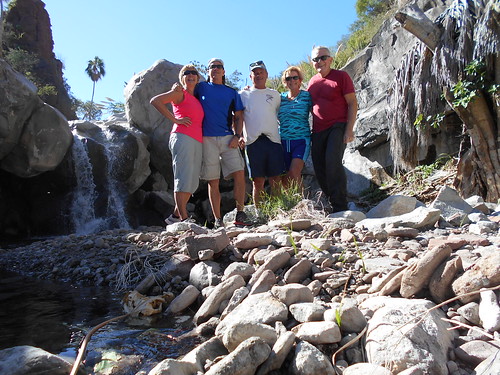
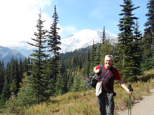
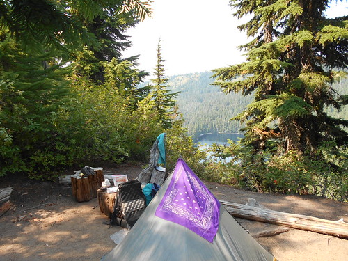
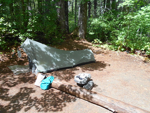
Ligui Canyon Group
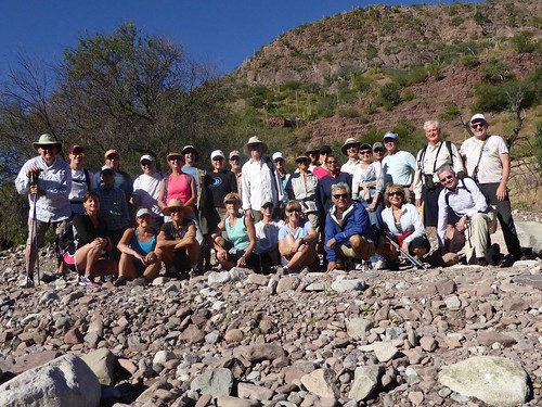
Tabor Canyon Group
Pinturas Canyon Group
2nd Pinturas Canyon Group
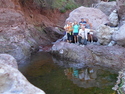
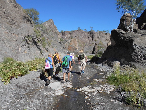
Del Borracho Canyon Group
Pinturas Canyon with Hollidays and Clarks
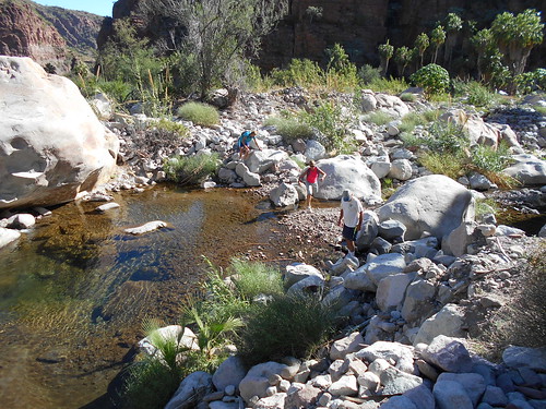
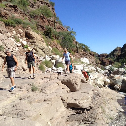
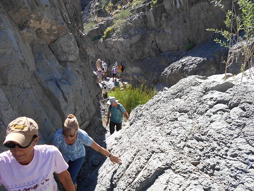
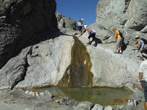
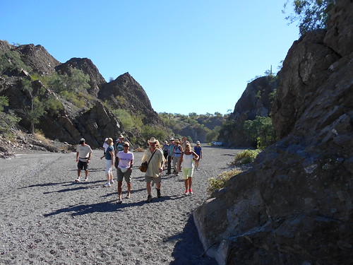
The week before the hike, I tell people what hike I am doing and whether we need 4 wheel drive cars to go up some of the dirt roads and riverbeds. We meet up and carpool to the hike site, which is almost always an up and back hike so that those who decide to stop along the way at one of the many pools or waterfalls can rejoin us for the hike back to the cars. These are not normal hikes with trails, but rather boulder hopping up the river beds that change from season to season.
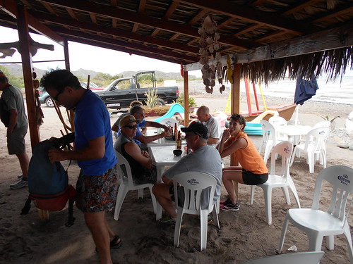
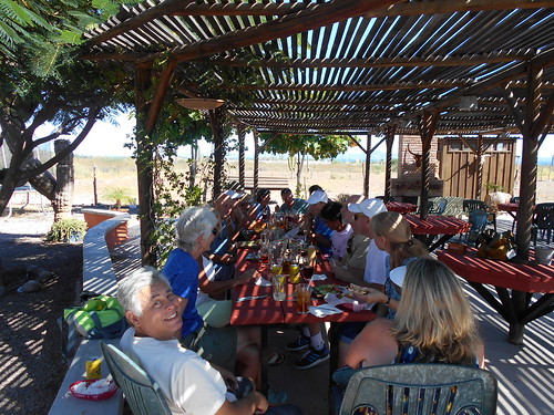
After the hikes, we stop for food and beverages at a couple of our popular restaurants---the Clam Shack right on the Sea of Cortez that serves delicious stuffed clams, fish, ceviche among other entrees, and Del Borracho's that serve Del Borracho burgers with all the fixins' including cooked onions and bacon or enormous taco salads washed down with Negro Modelo beer in pitchers on tap.
Clam Shack
Del Borracho's
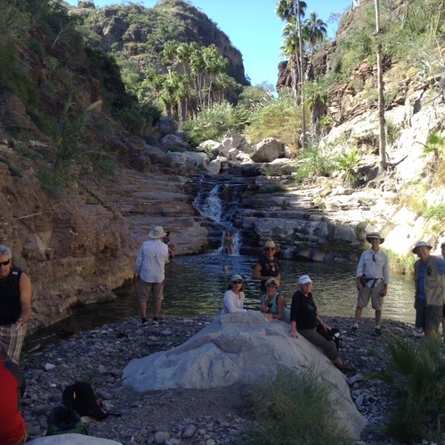
Both during the hikes and afterward while waiting and eating our lunches we have an opportunity to meet and talk with others who we have seen from season to season or get to know new people whose common interest is hiking and exploring this beautiful place in the Baja.
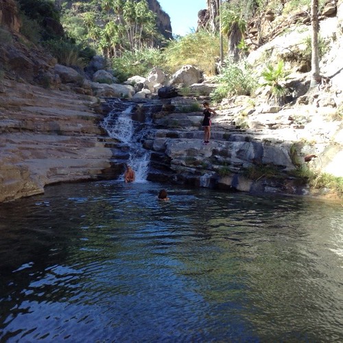
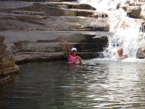
I really enjoy hearing from people who have lived down in Loreto for up to 10 years, but it was the first time they experienced hiking up these water-filled arroyos. The scenery just took their breath away as well as for some, a quick plunge into one of the cool and refreshing deep pools.
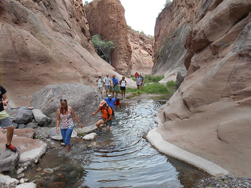
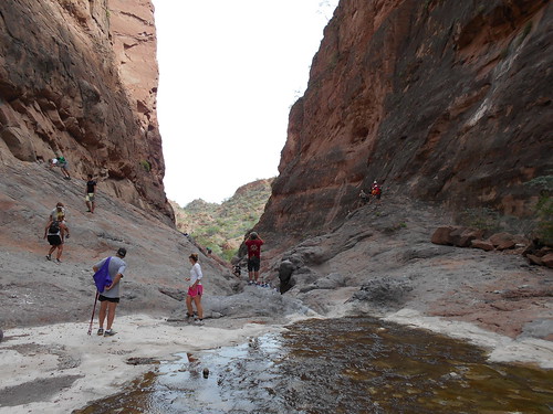
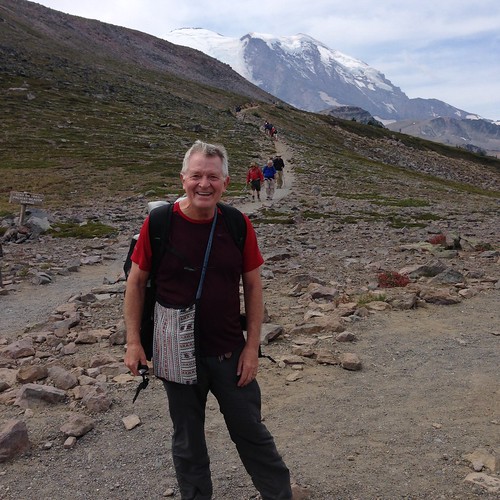
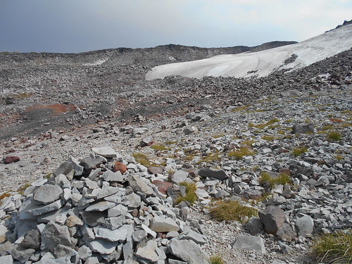
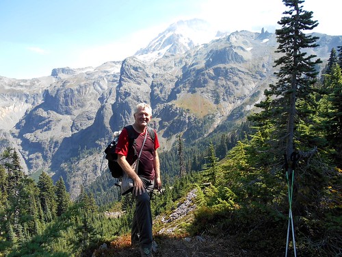
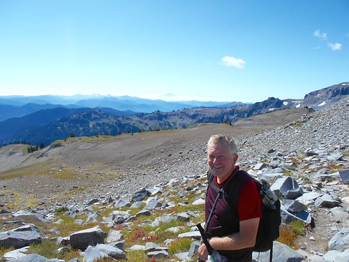
Here are some pictures of our Loreto Bay Hikers along with the places we experienced. My first hike upon returning to Loreto was just me on the Pinturas Canyon hike. After that those that joined me increased from 18 to 22 to a record of 52 hikers that ventured to the Ligui Canyon hike that involved a convoy of eight 4 wheel drive cars and 52 hikers about 3.5 miles up the river bed to near the entrance to the canyon. 22 of those hikers scaled the "scary wall" to continue up the narrowing river-filled canyon. After about an hour, we turned back with more of Ligui Canyon to explore on another trip.
2nd Pinturas Group
Tabor Canyon Group
Del Borracho Canyon Group
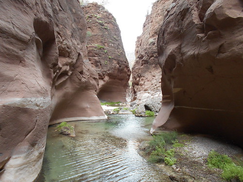
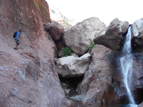
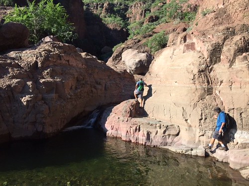
Ligui Canyon above the "scary wall" area
At the Ligui Canyon "scary wall" area
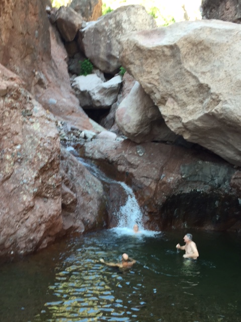
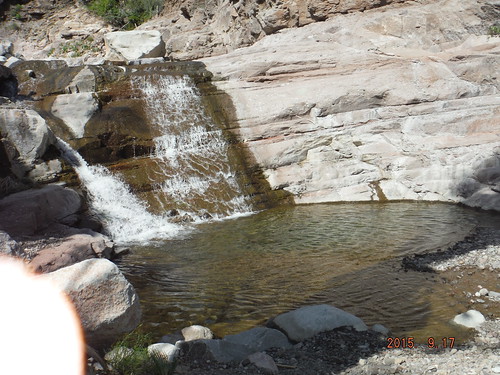
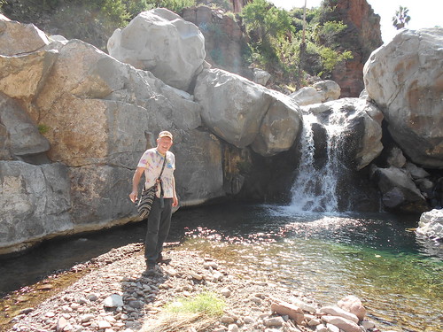
Deep pool in the Pinturas Canyon
Del Borracho Group
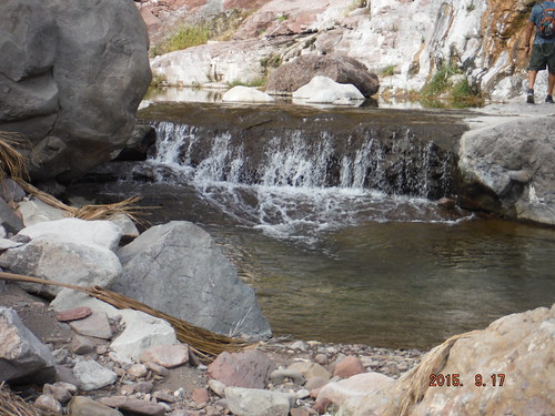
Pinturas Canyon cascades
Del Borracho Group
Ligui Canyon Group as the canyon narrows
She forgot to take water.
I am hoping the Loreto Bay Hiking group continues in my absence and I look forward to resuming these hikes in mid-March when I return to Loreto.
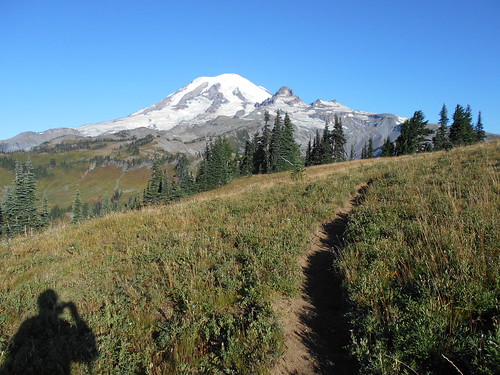
This is the year I planned to hike the Wonderland Trail on Mt. Rainier-- the elevation of 14,410 feet--- which is about a 90-mile hike that goes around the "Mountain". During this hike, you gain and lose about 22,000 feet of elevation-----about the same amount as if you were to climb Mt. Everest from its base camp.
My references for this upcoming hike were the book, Hiking the Wonderland Trail,by Tami Asars, and the National Park Service Mount Rainier map. Her book was invaluable because it details
the planning process for getting the right itinerary for your hiking abilities,
detailed route descriptions with maps, elevation, and mileages between the Park Service camps which you are required to stay at,
sample itineraries which I used for navigation and references.
Spray Park route alternative to the Wonderland Trail,
sample itineraries, both clockwise and counterclockwise directions, ranging from 7 to 13 days.
beautiful photos of some of the places along the Wonderland Trail.
I cut out the maps, sample itineraries, elevation gains and losses including the trail elevation profile to take with me and left the rest of the book behind.
One of the first things I learned is that I could not just go up to the trail and begin hiking anywhere I wanted to at any time, unlike my Pacific Crest Trail experience. Instead, beginning March 15th, the Park Service would accept applications to hike the Wonderland Trail. I filled out my form and sent it in for an 8-day hike beginning at the White River Campground, I listed each of the campsites I wanted to stay at and also indicated that I was flexible on the number of days, campsites and direction---clockwise or counterclockwise. Despite my flexibility, my application was rejected. According to Tami's book, the Park Service reserves about 30% of the campsites spots for drop-ins. So I would now be a drop in.
My pack weight was 12.1 lbs of gear including sleeping system, backpack, tent, stove, down parka, long sleeve shirt, and longjohns, rain gear, along with the other 10 essentials. I packed 11 lbs of food which was for 10 days, in case I couldn't get a shorter itinerary. Also, I was carrying all of the food since I did not want to bother with caching it at some of the Park Service caches located in several places around the trail like at Longmire. My 23 lb pack was the heaviest pack I have carried in a long time, but my Gossamer Gear Mariposa pack was a comfortable fit, especially when I occasionally used my hip belt to relieve the pressure on my shoulders.
I decided to take a bus from home out to Enumclaw--the nearest metro bus stop to the entrance to Mount Rainier National Park. I boarded the 578 bus at 5:08 am on Monday which took me to the Auburn Transit Center where I caught my final bus 186 to Enumclaw right by Highway 410 at Mc Donalds.
I got to Mc Ds at 6:45 and had a big breakfast and then headed out to the adjacent Highway 410.
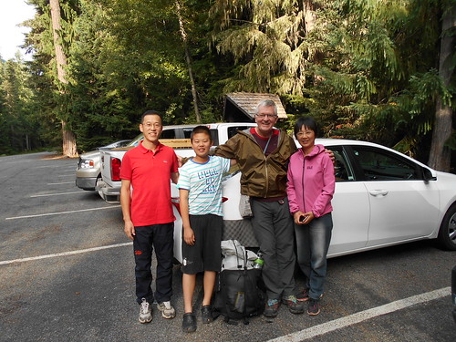
It took me about 45 minutes before the Pan family from Beijing, China picked me up and drove me about 45 miles to the National Park Service White River Information Center.
Here is a picture of the family posing with me outside the Center. David Pan is a surgeon and his wife is a pediatrician, Following the "one" child China policy they have a boy about 11 or so. All were very fluent in English. They described how in this trip to the US they had visited all of the National Parks in the Western States, including Zion, Bryce, Grand Canyon, Yosemite, Mt. St. Helens and others including now Mt. Rainier.
I waited my turn to get an approved itinerary from the Park Ranger. I was hoping to get a 7 or 8-day itinerary because I much prefer hiking over camping. He discouraged me from doing any hikes over 15 miles because of the huge ups and downs of the trail as it traversed the numerous river valleys. We began to pick out available spots and soon I had built a workable itinerary going counterclockwise.
My only disappointment with this itinerary is that I would not have a camp at either Indian Bar or Summerland on the east side which is two of the most scenic spots of the Wonderland Trail.
As I hiked, I eliminated my two approved stop at Pyramid Creek and Ollalie Creek Camps and reduced my hike by one day. Instead, I stayed at the Longmire staff campground after not being able to get a room at the Longmire Inn during heavy rains that day and night. Instead of camping overnight at Ollalie Creek Camp, I hiked from Maple Creek all the way back to the White River Campground where I started my journey. The last day was the longest at 21.2 miles, but it was fairly easy since my pack now only weighed 12 lbs. and the scenery was breathtaking with big vistas and clear weather.
This is a summary of my journey on the Wonderland Trail:
8/10 Mystic Lake, 12.3 miles, 3,800 ft. elevation gain, 2,400 ft, elevation loss
8/11 Eagles Roost, 11.2 miles, 3,280 ft. gain, 3,580 ft. loss
8/12 Golden Lakes, 11 miles, 2,890 ft. gain, 2,832 ft. loss
8/13 South Puyallup, 12.5 miles, 2,600 ft. gain, 3,300 ft. loss
8/14 Longmire, 12.0 miles, 2,700 ft. gain, 4,126 ft. loss
8/15 Maple Creek, 10.2 miles, 2,080 ft. gain, 2,054 ft. loss
8/16 White River Camp--End, 21.2 miles, 5,630 ft. gain, 4,130 loss.
Total miles hiked including Box Canyon Round trip hike on 8/15-----95 miles
Total elevation gain----22,980 ft.
Total elevation loss----22,422 ft.
I then got another hitch from two women who were doing a day hike to Summerland. They dropped me off at the White River Campground for the start of my hike that day to Mystic Lake.
My hike began at 9:45am with a 1,900 ft. climb on a series of steep switchbacks to Sunrise Camp. The views were spectacular and the trail was filled with day hikers until I headed down toward Granite Creek camp and my Mystic Camp where I would spend my first night on the Wonderland Trail. I would end up crossing paths several days later with some of the thru-hikers that were going clockwise on the trail.
Many of the day hikers were heading up the Burroughs Trail right behind me which would give those hikers a more spectacular view of the east side of Mt. Rainier.
I continued on the trail from Sunrise to Granite Creek Camp which involved a 1,200-foot drop into the forest with few views of Mt. Rainier.
The trail to Mystic Camp travels along the side of the rock covered Winthrop Glacier where you can barely see the ice underneath.
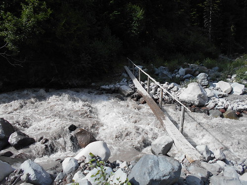
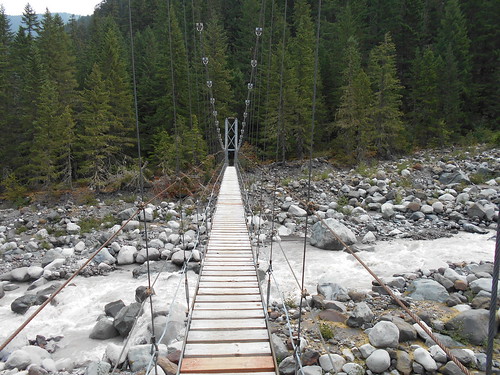
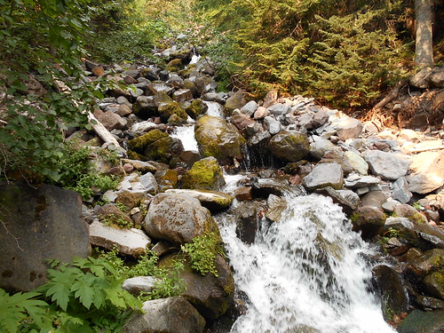
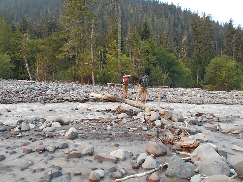
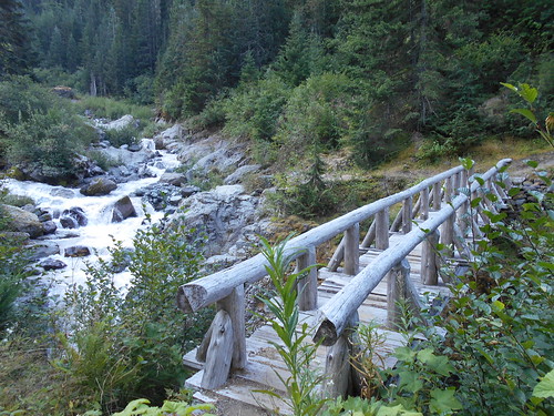
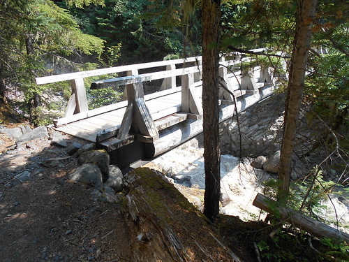
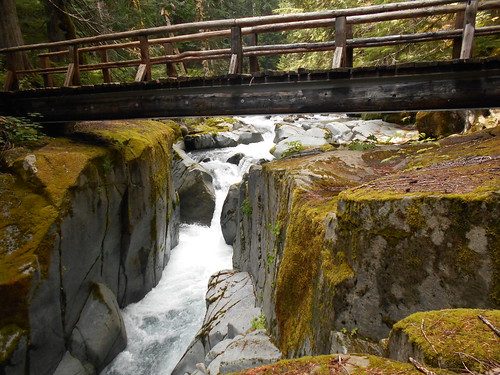
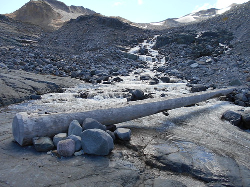
The Park Service has several of these kinds of log bridges that span the several silty glacier-fed rivers including this Winthrop Creek crossing. Angry waters plummet down the waterway to smooth the once rough boulders and wash aside these bridges. The Park Service usually anchors one end of these bridges with a cable bolted into rocks so when the summertime hiking season arrives, they can retrieve the washed away bridges and reset them only to repeat the process the following years when the water runs high.
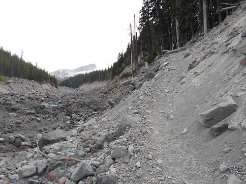
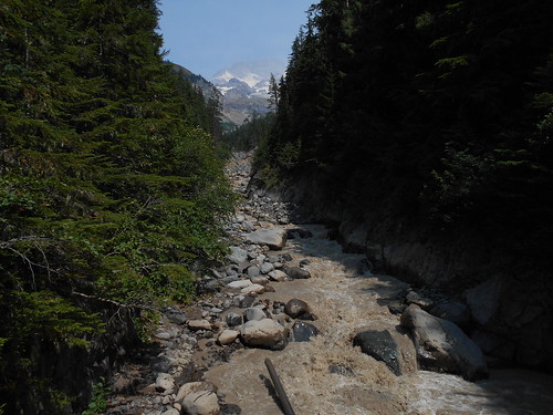
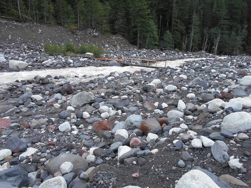
The next river crossing is the West Fork White River where previous floods have left large silt and rock wash where a bit of rock hopping did the trick.
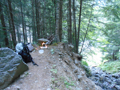
I got into Mystic Camp at 4:45pm and set up my tent in Campsite #1 of 7 which was near both the bear pole----where we hang our food bags away from any curious critters including bears----- and the toilet, but farthest from the creek for water which I used for cooking and cleaning. Just as I was finishing up my dinner of chicken with cornmeal stuffing and cocoa using my pop can alcohol stove, it began to rain. After an hour, the rain stopped and the clouds blew away, so I took a walk up to see Mystic Lake in case I started hiking the following morning before it was daylight.
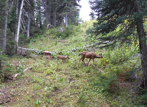
In the meadow just before the lake, I saw this doe with her two fawns grazing among the ground cover and blueberries. They did not pay me much attention as I continued up to Mystic Lake. The small mountain on the opposite side of the lake obscured my view of Mt. Rainier.
This was the log bridge that crossed the Granite Creek on my way to Mystic Lake.
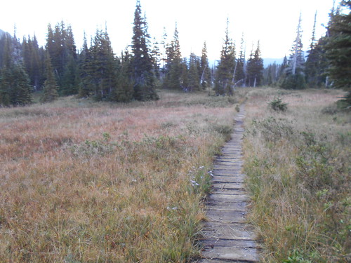
With an early bedtime of about 8 pm, I woke up around 5 am and began hiking on the second day about 6am just as dawn was breaking. I walked on this wood plank covered trail through the Mystic Lake meadow. This would be one of many of these plank covered trails that the Park Service uses to keep the trail from being a deep ditch along with this type of fragile land.
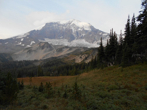
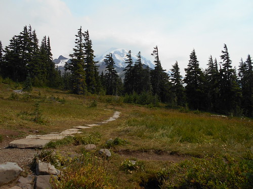
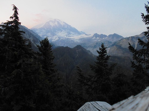
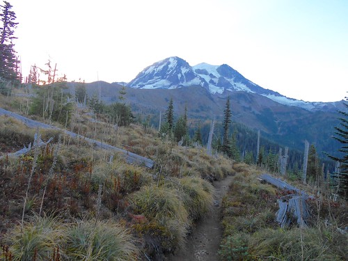
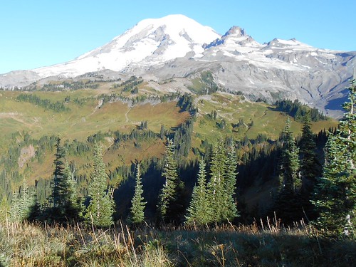
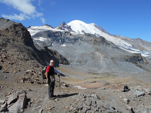
When I climbed to the saddle, I got this fulsome view of Mt. Rainier.
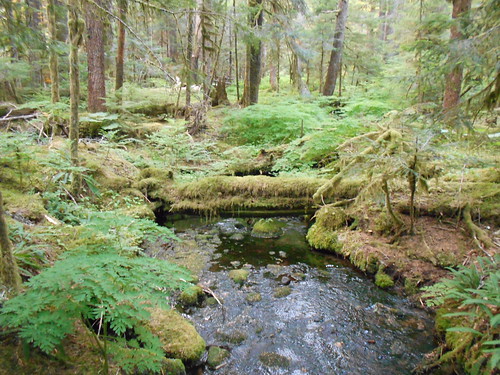
For drinking water, I relied on the many small streams that crossed the trail instead of the turgid glacier-fed grey-brown rivers.
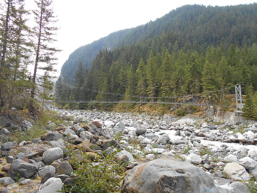
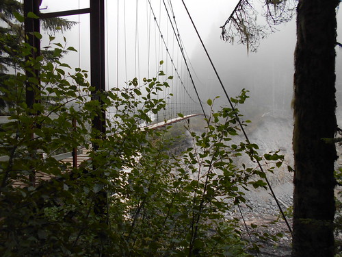
When hiking, I always pack up in the morning and then walk until I get to a warmer, scenic place for breakfast. This morning, I stopped at about 8am at Dick's Camp along with the 1, 700 ft. drop to the Carbon River suspension bridge from Mystic Lake.
The sign on the bridge advises just one person at a time cross which became apparent as I began walking across with so much swaying that I grabbed the wire rails for support and safety.
After crossing this bridge the Wonderland Trail splits into two choices: the traditional Wonderland Trail that goes further away from Mt. Rainier to Ipsut Creek, and the Spray Park Trail. The thick wooded and overgrown trail gives way to more meadows as I continued my climb to the tree line on the Spray Park Trail.
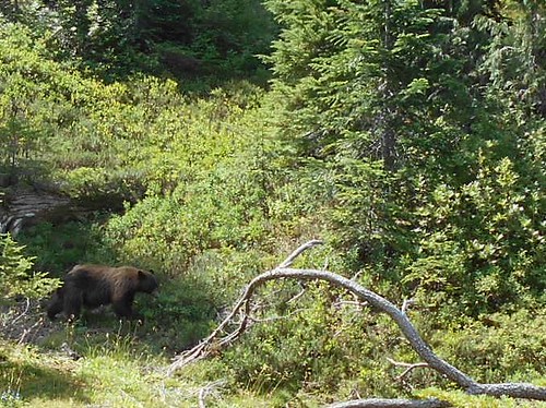
In one of the meadows, I spotted this brown bear plowing through the ripe blueberry fields and ignoring me in his quest for a meal.
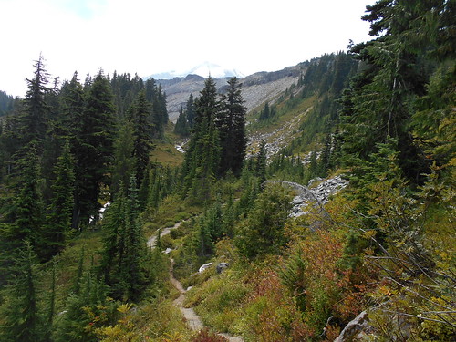
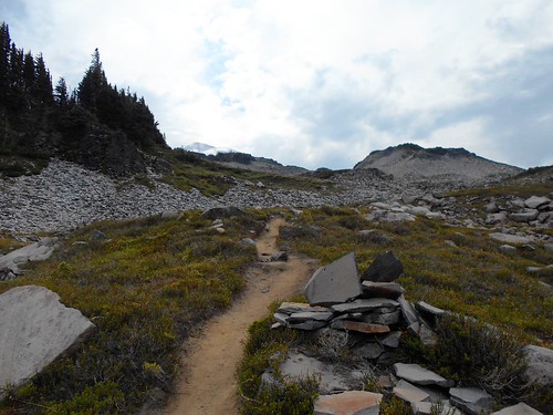
After breaking through the tree line, I found myself in a maze of jumbled rocks with the trail occasionally marked with large rock cairns to point the way through Spray Park.
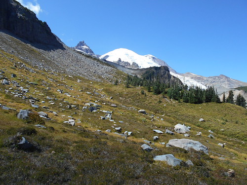
As I headed down from Spray Park, I passed some beautiful blueberry covered meadows with great views of Mt. Rainier that was partly obscured by the forest fire smoke from Eastern Washington.
I finally reach Spray Falls at 2pm and my nearby camp at Eagles Roost. The camp is deep in the woods and not what I would imagine being suitable for eagles to roost in. The 7 campsites are well scattered for privacy down the side of the trail. I would have liked to hike more, but my permit required me to stay at my designated campsites. The Park Service needs to spread out the visitors so they can enjoy a wilderness experience and to lessen the impact of hikers on the land.
After a dinner of chicken with stuffing and cocoa again, I climb into my tent for an early bedtime around 7 pm with another early morning departure at 6 am.
Here is my first-morning view of Mt. Rainier along the South Mowich River area.
Most of this morning's hike is through the forest with a log crossing on the South Mowich River before arriving at Golden Lakes.
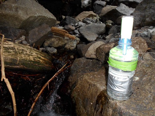
I used my steripen at this creek with my recycled drink bottle wrapped with duct tape and masking tape.
I later passed these two hikers as they cross the South Mowich River on this log bridge.
I arrive at my Golden Lakes Camp at 1:45pm and score the best campsite---#4---that overlooks one of the Golden Lakes.
Since I had so much time on my hands, I took an inventory of my food and decided to offload about three days of meals and snacks so my load would be lighter. I had carried extra food in case I had to do the Wonderland Trail in 10 days which was no longer the case. My campsite neighbors were glad to get some different breakfast food and snacks. For dinner, I had salmon with top ramen and cocoa.
When I returned to my campsite, I noticed that my tent was covered with fine ash from the Eastern Washington forest fires. I had noticed the plumes of smoke obscuring a clear view of the Mountain and that the sun was now a big orange ball, but I did not realize that the ash would spread so far.
During the night, I decided to pull down my tent and cowboy camp so I could watch the expected meteor shower. I was not disappointed. Some of the meteors streaked halfway across the sky and sometimes I would see two or three streaks by at the same time. Finally, sleep got the better of me.
After another early rise, I got my first dawn glimpse of Mt. Rainier while hiking through this old burn site. This picture does not do justice to what I saw. The entire north side of the Mountain was a changing pink-orange hue as the sun rose.
I stopped for breakfast near the North Puyallup River and decided to have a hot cup of coffee along with my Quakers granola since I knew I had plenty of alcohol for the rest of my dinners, especially since I was planning to have dinner at the Longmire Inn.
I crossed this heavy-duty bridge over the North Puyallup River. While I was there a group of 5 women hikers arrived and I took their picture as they were finishing up their Wonderland Trail at Mowich Campground.
During my hike, I think over half of the thru-hikers I saw on this trail were women. Later, I would meet three wiry women from Spokane who were slackpacking the Wonderland Trail in just 3 days. They said their spouses would meet them at trailhead campgrounds with food and shelter for the nights.
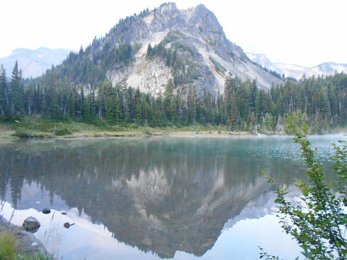
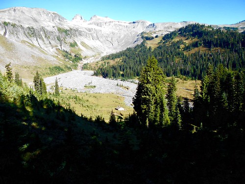
The Aurora Lake by Klapatche Camp was now just a dry lake bed, but still, the Mt. Rainier view here was spectacular.
Just over a saddle on the way to my South Puyallup Camp, I passed by the almost empty St. Andrews Lake where a number of hikers---a couple were skinnydipping---- were enjoying a mid-morning swim in the shallow waters and mud.
After leaving this lake, I dropped about 1,800 ft. to the South Puyallup bridge similar to the North Puyallup bridge. You get a sliver of a view of Mt. Rainier up the South Puyallup River Valley.
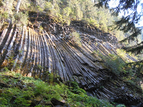
I arrived at the South Puyallup Camp around 3 pm. The normal water supply had dried up and the S. Puyallup River was silty, so I hiked about 10 minutes up the trail to get water and wash out my sweaty shirt. For dinner, I again had the rest of the salmon with top ramen along with coffee. After dinner, while walking to the Park Service toilet, I passed along this beautiful wall of andesite columns that are found throughout the Mt. Rainier area.
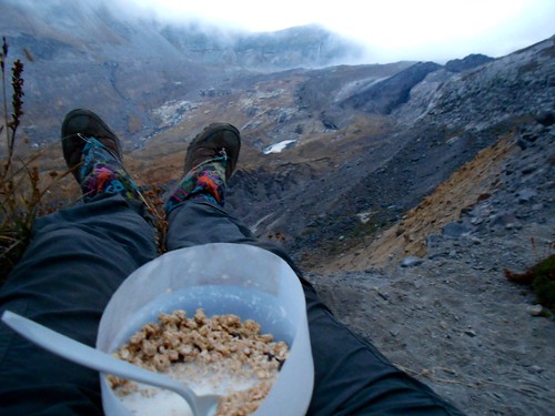
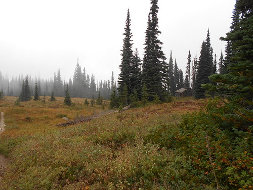
In the morning, I noticed that there was some fog along the trail on my way to my next scheduled camp at Pyramid Creek. As daylight came, I stopped for breakfast that overlooked the huge Tahoma Glacier but was now obscured by fog--clouds--drifting through. I sat on the lip of the hill that overlooked the glacier. You can see my "dirty girl" gaiters---along with my bowl of Quaker granola as I eat my breakfast wishing the fog would clear so I could see the Mountain. It was not to be for the next two days.
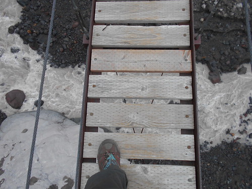
After breakfast, I headed further down the trail along the glacial moraines to cross the wobbly and very high Tahoma Creek Suspension bridge swathed in fog.
No rotten boards, please.
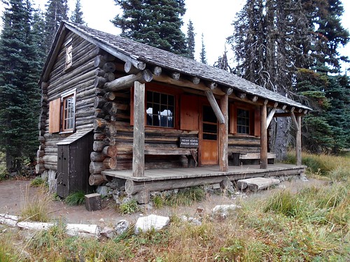
After a big climb out of the Tahoma Creek Valley, I came upon the Indian Henrys Hunting Ground. At this Park Ranger cabin---the oldest one in the park-----, I learned from the Ranger there, that the fog was going to turn into thunder, lightning, and rain. Not a good prospect. At that point, I decided that I would not stay at Pyramid Creek Camp as planned, but rather continue down to Longmire to try to get a room for the night at the Longmire Inn.
After this photo of Squaw Lake, the heavy fog began to turn into rain. I found myself jogging down the smooth portions of the drop-down past the Devils Dream Camp and Pyramid Creek Camp as the rains increased. After crossing Kautz Creek it was more switchbacks down until I came out at the road near Longmire with its Park Service Information Center, Museum and Inn.
I left South Puyallup Camp at 4:30am and arrived at Longmire at 10:30---about a 2 mph average including a stop for breakfast and meet up with the Ranger and other hikers. For the day, I descended 4,126 ft. and climbed 2,700 ft. on my 12-mile journey to Longmire.
Here is the Park Service Information Center where I notified the staff that I was canceling my two camp reservations at Pyramid Creek that I had just passed and Ollalie Creek which was near Maple Creek, which would have been my last night on the Wonderland Trail.
Here is a picture of the downpour from the dry and comfortable restaurant at the Inn. At the time I arrived no rooms were available, but they put me on the waitlist in case someone would cancel because of the inclement weather. I had fish and chips with clam chowder and coleslaw with berry cobbler for lunch as my wet clothes dried out and my iPad and cell phones recharged. After lunch, there was still no room available.
I spent the afternoon in the shelters of the Park Information Center, the Museum, and the Inn. I sorted out my food again and handed over about two more meals that were extra to the Park Service staff to put in the Hiker Box---like on the Pacific Crest Trail, a hiker box is where hikers stash food they do not need or like anymore and even exchange for other food that was donated. Sometimes even spare equipment is left in the hiker boxes.
It was still raining as the restaurant prepared for the 5 pm dinner time so I decided to stay there and have dinner. I had delicious flank steak on a bed of chard and other greens along with another berry cobbler.
I asked Robbie, the Inn staff member if any rooms were now available and the answer was no. He then told me that I could try to stay at the nearby staff campground just across the Paradise River from the Inn. After putting on my rain gear, I began walking there when a fellow stopped his car and gave me a ride to the campground which was about a half-mile away in the rain and dark.
Once I got there, I decided to drape my tent over a picnic table and crawl underneath out of the heavy rain to sleep for the night.
Early the next morning it was still cloudy, but it was no longer raining as I resumed my hike toward Maple Creek.
Another log bridge gets me across the Nisqually River shortly after leaving Longmire.
Carter Falls was a wonderful place to stop for breakfast of Quaker granola---I never get tired of this meal--and hot coffee.
I arrived at Narada Falls where I was met with several tourists who had taken the short hike down to the falls from the roadway you can see just above the falls.
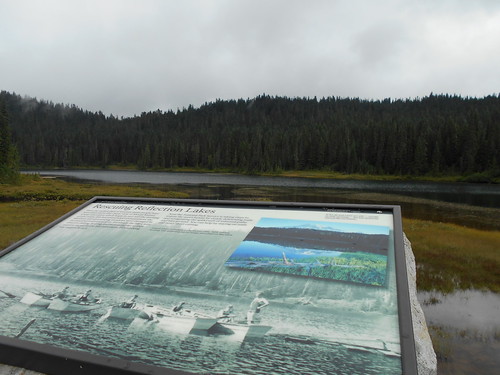
The Reflection Lakes usually provide the most scenic view of Mt. Rainier, but not today. You can only see Mt. Rainier on the upper left-hand corner of the NPS display that also shows that in the early years, people use to swim, boat and fish in this lake---but no more.
The clouds began to break apart as I came into Maple Creek Camp. Easy to see why it is called Maple Creek after walking over an hour through vine maples that filled both sides of the trail. I arrived there at 12:45pm.
Since I got here so early, I decided to walk the 2.4 miles to Box Canyon and back. Since I would be passing by Box Canyon in the dark the following morning, I figured this would be the only way I could see this Box Canyon.
On the way to Box Canyon, I passed over Stevens Creek as it plummets through this slot canyon.
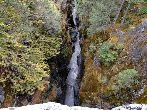
Here is the Box Canyon that is a very deep narrow channel that the Cowlitz River passes through. This narrow and deep box canyon is about a quarter-mile long.
I saved my best dinner for the last night which was real bacon bits with mashed potatoes along with coffee.
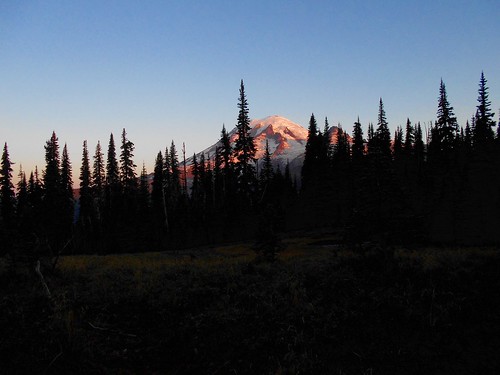
Excited about hiking on my last day, I woke up at 3am to see that the sky was clear and filled with stars. That really pleased me since the Indian Bar and Summerland areas on the east side of Mt. Rainier were some of the most beautiful areas in Mt. Rainier National Park. Using my flashlight, I began walking and hoping that I would be able to get out of the forest and have a view of the sun first hitting Mt. Rainier.
It seemed that although I was high enough to see Mt. Rainier, the trail designers decided to keep the trail on the backside of the ridge I was walking up. It wasn't until I approached the treeline that the trail swung over to give me a view of the Mountain. It was a bit after sunrise, but beautiful none the less.
Mt. Adams is to the south and you can see a lower layer of smoke from the wildfires from Eastern Washington. Mt. St. Helens is one of the lower lumpy mountains to the right of Mt. Adams.
Mt. Rainier with the rocky Mt. Tahoma jutting up to the right.
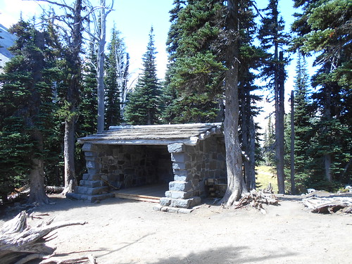
You can see the Indian Bar shelter built by the Civilian Conservation Corps in the lower right area of the meadow below.
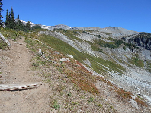
After leaving Indian Bar, I climbed another 1,800 ft. to the Panhandle Gap at the highest point on the Wonderland Trail at 6,800 ft.
I am at Panhandle Gap with a view of Mt. Adams in the distance.
From here it is almost all downhill to Summerland Camp and ending at the White River Campground where I started seven days ago.
Fryingpan Glacier Creek crossing----another cabled log bridge that gets repositioned most every year.
Summerland Camp along with Indian Bar Camp are the two most popular camping spots on the Wonderland Trail.
After leaving Summerland I head down the trail to where I started at the White River Campground. It is about a 2,100 ft. drop. I ended up doing a road walk on the last part of the trail since a recent flood of the White River had washed out the approach to one of the log bridges.
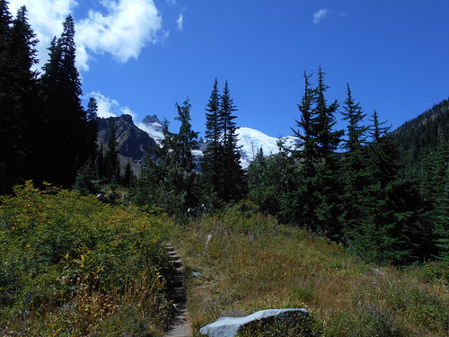
This is my last view of Mt. Rainier as I hike along the Wonderland Trail to the White River Campground about 7 miles from Summerland to the camp.
I got to the intersection of the White River Campground and the road from Sunrise at about 4pm and got a ride within about 20 minutes from a Russian family who lived in Sammamish. I helped them a bit with the navigation even though he had Goggle Maps and a talking car to guide him. Ivan's wife, Elena, worked for Microsoft, and I believe he was a computer consultant. Their 3-year-old girl, Maria, enjoyed playing Angry Birds on my iPad as we returned to the Seattle area.
They dropped me off at the South Bellevue Park and Ride just as the 550 bus to Seattle was arriving. What a great hitch and an enjoyable way to share experiences with Ivan and his family.
I got home at about 6pm and enjoyed a hot shower and clean clothes along with some dinner and a cold beer.