Monday, May 2, 2016

Amazing Spring 2016 Loreto, MX hikes

I was recently made aware that to access the hikes I have shown on my blog and described in the Hiking Loreto guide book, requires permission from the ranch owners of the land.  


You can contact the president of Loreto Guide Association, Rodolfo Palacios Castro, for a guide to take you on these hikes because they have permission from the owners and are aware of the need to protect these fragile places.  His Facebook site is:  


Currently, the owner of the Las Parras Ranch along the road to San Javier Church sells passes to their property at the Pescador Grocery Store or Hacienda Suites.  As time goes by, there may be more owners who do this.


Although I left Loreto in mid-November 2015, the Loreto Hikers group continued to explore the hikes around Loreto, Mexico described in the “Hiking Loreto” guide book written by DeeDee and Dave Kelly, and Ed Nugent.

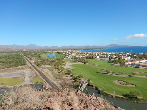
North view of Loreto Bay, Sea of Cortez, and Mex 1 Highway.


When I returned in mid-March I joined up again with the Loreto Hikers group of 21 on the Hart's Trail hike that overlooked the Escondido harbor and the Las Sierra Giganta mountain range. It was a short uphill climb from the Rattlesnake Beach where gringo RVs and trailers were nestled among the mesquite trees stretched out along the shoreline.


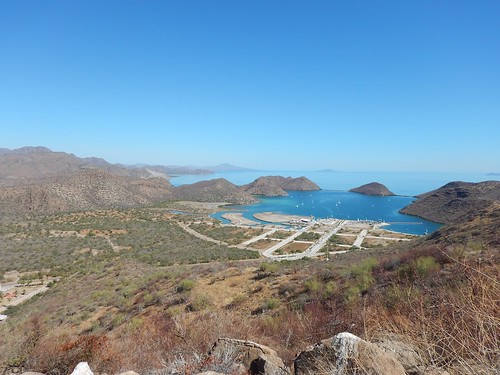
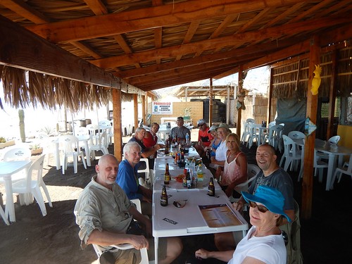
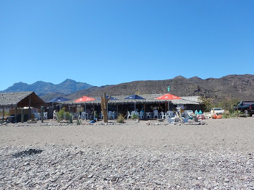
Afterward, we had lunch and refreshments at the Clam Shack which is a regular stop when we hike south of Loreto Bay.

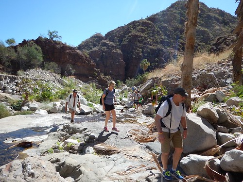
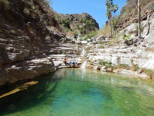
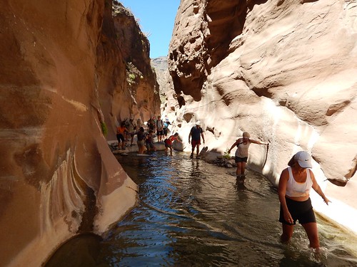
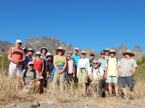
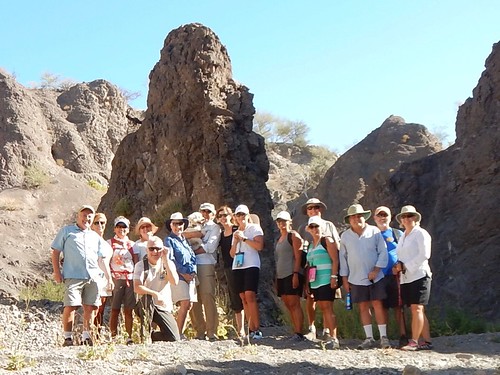
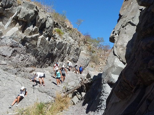
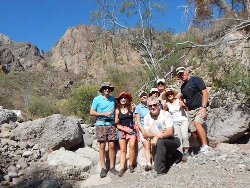
On March 24th I led 21 Loreto Hikers to one of our favorite hikes to Las Pinturas where we hiked along the river that had four pools along the rock hopping route.


At the top, several of us swam in the upper deep pool which was a refreshing 68 degrees.


We then headed down and many of us stopped at Del Borrachos’ bar and restaurant for refreshments and lunch—think juicy cheeseburger with bacon and fried onions with a Modelo Negro or Limonada.

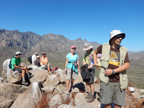
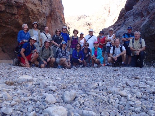
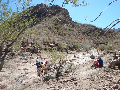
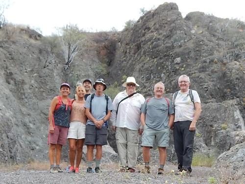
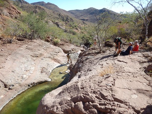
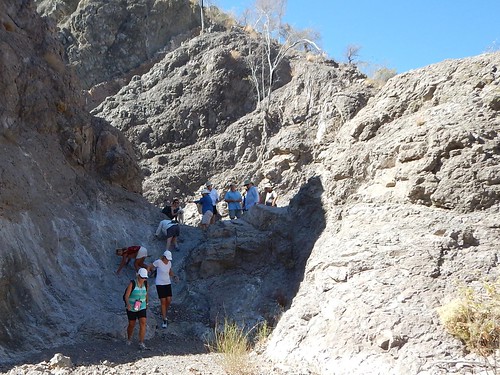
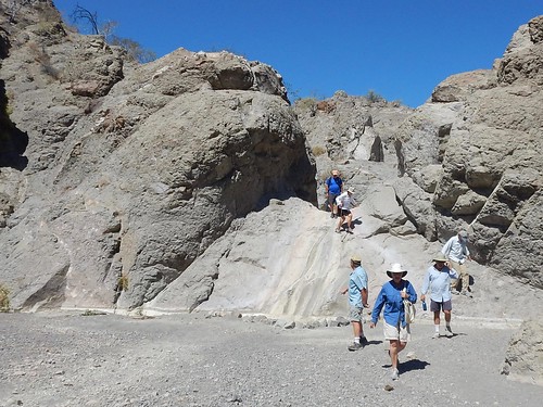
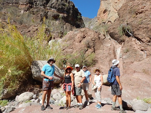
On March 31st we returned to Ligui Canyon with just 20 Loreto Bay hikers where most of us headed up the rim trail—also known as poo-poo trail from the cow pies scattered along the way—about 3 miles it joined the upper Mesquite canyon. In our fall hike to Ligui Canyon, we had a record-setting number of 52 hikers--not to be repeated.
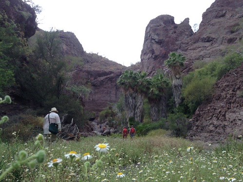

Poo-poo Trail


We then headed down into the water-filled narrow canyon.


With help from the more agile hikers, all hikers made it past the lower sketchy part of the trail by the waterfall near the entrance to the canyon.

We then celebrated completing this challenging hike with a stop at the Clam Shack—-no clams though while the health and number of claims in the Sea of Cortez are being assessed by the government.


On April 7th, 7 Loreto Bay hikers traveled to the Jack and the Beanstalk trail, but we first had to drive about 2.8 miles up the San Thelmo arroyo and then right up a smaller arroyo where we could go no further in our 4 wheel cars.


We then headed up a now dry river bed with steep walls ribboned with basalt and lots of green plants that must have been drawing water from slightly beneath the gravel river bed.


When we came around the corner where some remaining pools were still present amid the huge boulders, I realized why this trail was called Jack and the Beanstalk.

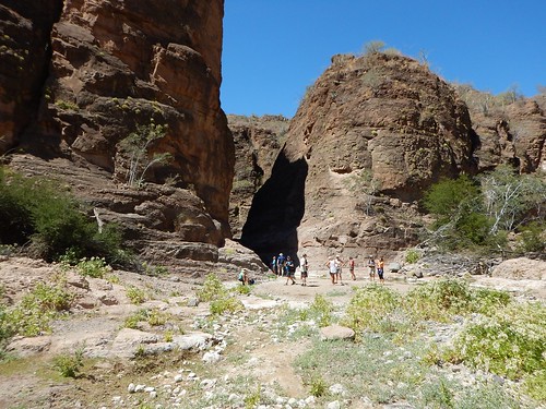
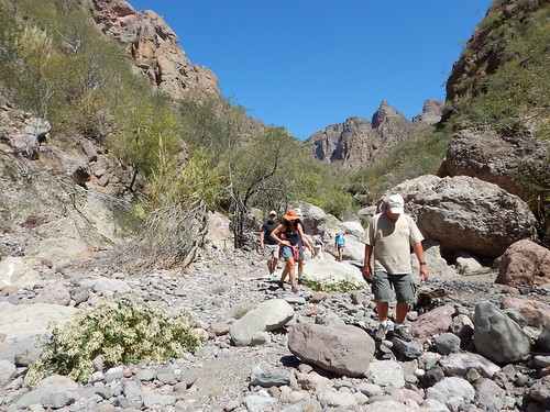
We entered a huge amphitheater where there was a huge fig tree with a root and trunk that was over 100 feet in length that looked much like a giant beanstalk. We felt dwarfed in this amphitheater—-truly an amazing sight. Del Borrachos was our lunch stop—-and we found no magic beans.


On April 14th, 17 Loreto Bay hikers revisited the Juncalito Sur hike, where we found most of the flow had slowed considerably and there were some stagnant pools. Most of the hikers made it up to the upper pool past the loose gravely area where a couple of us went swimming. Afterward, it was another stop at the Clam Shack for lunch.


On April 21st, 15 Loreto Bay hikers and one dog visited the Del Borracho arroyo after crossing the San Thelmo arroyo at 3.4 miles up to San Javier Road in our 4 wheel cars. This hike was mostly a trail walk rather than the more frequent boulder hopping found on most other arroyo hikes in the Loreto area.


This was another interesting canyon with lots of twists and turns along with a short climb up a now dry waterfall.


We also headed up the canyon to the left which ended up being a dead end so we returned and continued up to near the top of the canyon. On the way back many of us stopped off at Del Borrachos for lunch.


On April 28th, 8 Loreto Bay hikers travel 2.2 miles south of the Escondido exit where we began our 5-mile round trip hike up the Rainbow Rock Canyon.


On our way up the canyon, we would see bands of red rock and green rock as well as in the far distance we could see some vertical bands of green and red rock which gave this trail its name.
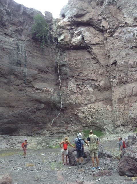
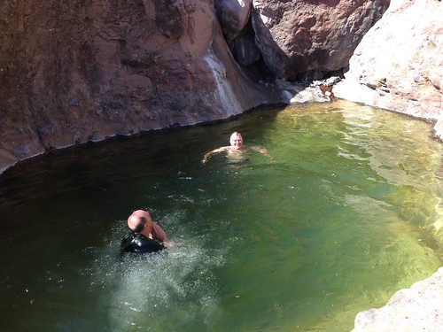
Near the end of our hike, we stopped at the twin waterfalls and there was just a trickle coming from one. I was able to refill my water bottle from the small pond found at the bottom of the waterfalls.


We continued up the boulder-filled arroyo for another ten minutes for a closer view of the rainbow rock walls in the distance. After returning to our cars, we stopped at the Clam Shack for lunch.


View of the Clam Shack from the water edge.


On May 5th, I will be leading experienced hikers back to Ligui Canyon where we plan to hike up the canyon as long as we enjoy it and then return on the rim canyon Poo-poo trail.

On May 12th, my final Loreto Bay hike, we will return to one of our favorite hikes: Pinturas Canyon.

No comments:

Post a Comment