Sunday, June 26, 2016

Hot Springs to Sam's Gap---273.7 to 317.6 miles---Summer 2016

It turned out that I was the only person in my 5 bunk room so I got some peaceful sleep until the thunder, lightning, and rains began around midnight. I was glad to be here rather than in my tent in this weather.

June 24, 2016
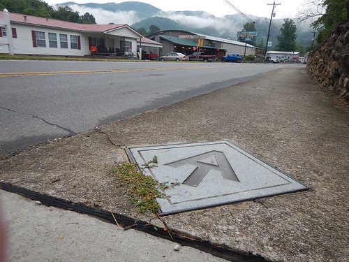
With fresh clean clothes, I followed the AT markers on the pavement to the Smoky Mountain Diner in Hot Springs, NC where I had endless cups of coffee along with one of my favorites: 2 eggs over easy with hash browns and two strips of bacon. I passed by the grits, chicken fried steak, biscuits with two types of gravy, and other southern breakfast specialties.


I then resumed my AT trail walk through town with these pavement inlaid markers to the end of town where I crossed the wide French Broad River and then down to the right where the trail goes up along the wooded riverbank.


After a few minutes, I came to a water-soaked bicyclist named Keith who was bicycling his way across the US. He had not put his rain fly until after the downpour began and his hasty job soaked most of his gear. Fortunately, the temps were in the 70s.

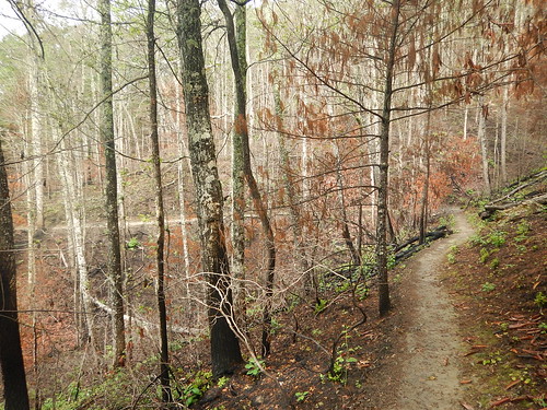
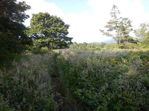
I began my hike up the side of the mountain to a point called Lovers Leap. The entire area was burned up along with another 4,000 acres. I would walk for 2 hours through this burn area and then another 2 where they had done some controlled burn of the understory of the forest.


Apparently, during the mid-April Trailfest---a gathering of AT hikers, some hikers who had taken LSD, caused a lot of problems to other hikers, townspeople so the police took him for medical treatment. During this time he ranted that he would burn the town down along with the people that bothered him.

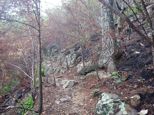
This was the worst fire they have ever had here, with the fire burning not only the understory but topping the trees and the winds blew the embers to start fires in other parts of the mountains. They had helicopter crews who drew buckets of water from the French Broad River. They also called in the California hotshot crews who would rappel down with their tools and chainsaws to quell this fire.


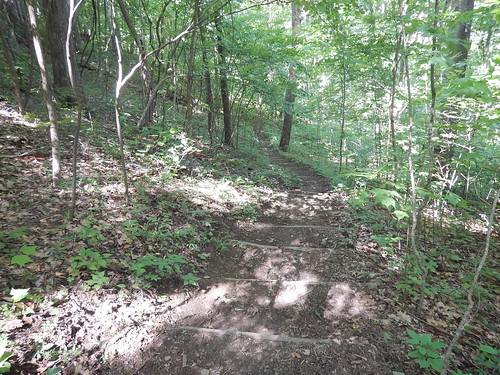
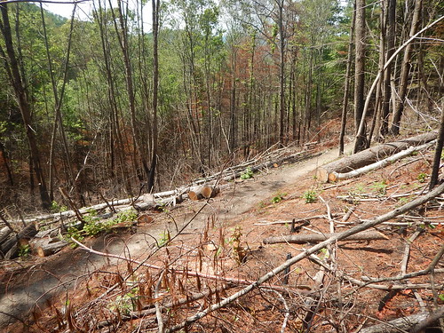
Welcome to the "brown tunnel"---a bit of change from the "green" one.


After about 3 hours of hiking, I came across what I thought was a southbound AT hiker who had been on the trail for about 3 weeks. He was actually a northbound hiker who had just reversed direction and was quitting his hike. He said he was tired of seeing just an endless procession of the "green tunnel" and all of the Boulder strewn ups and downs of the trail. He just wanted to take a plane out to Montana where he could see "the Big Sky" and surrounding territory. That got me to thinking that I had those same feelings.

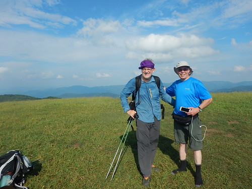
I began to think that maybe there was something else to do other than this boring walk. I guess my threshold for boredom on the trail was a lot more than Gary's who left after 6 trail days.
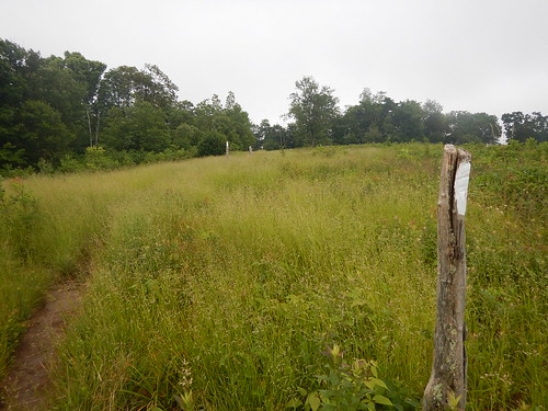
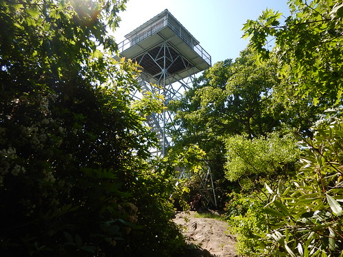
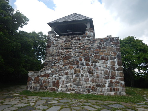
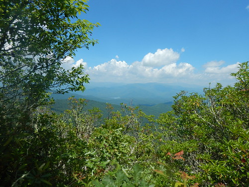
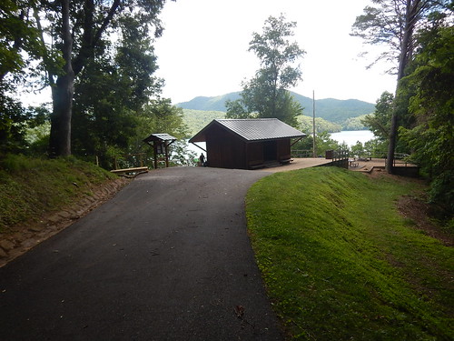
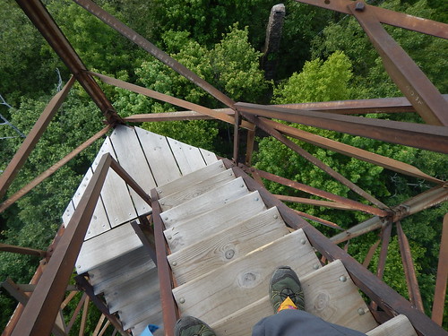
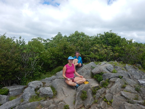
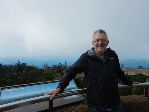
I had another view opportunity at the Rich Mountain Lookout tower---282 miles--early afternoon. With good views and interesting graffiti, I paused to take a few pictures before getting back in the "green tunnel".


When I was on the mountain top for cell phone reception, I called my wife. She commented that it did not look like I was having much fun in the pictures I had sent her. She said that I might take a break from the trail instead of continuing on to Harper's Ferry. I related my talk with the bored hiker and said based on her comments and his, I was going to end my hike in Erwin, TN---342 miles.
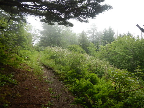
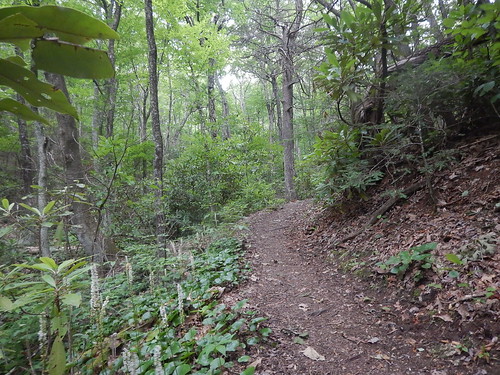
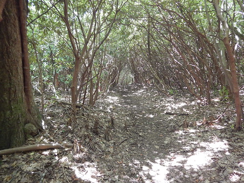
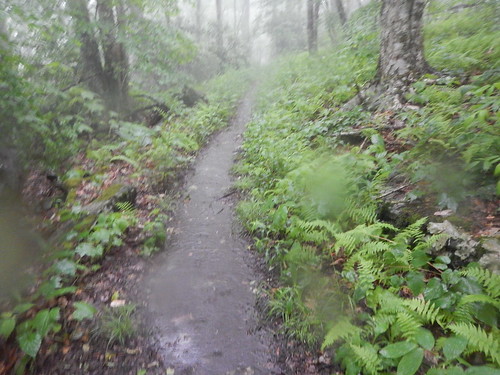
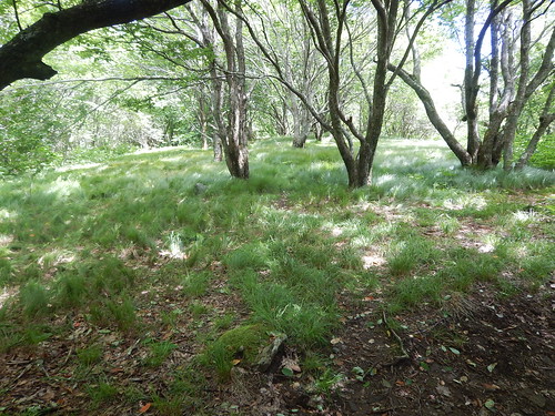
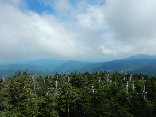
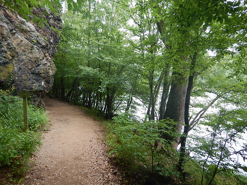
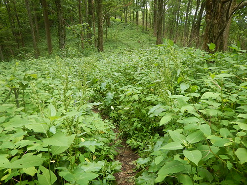
Here is a more intense green of the "green tunnel".


But first I had to get there. I made it about 9pm to the Little Laurel Shelter---293.3 miles--- that was not only full but filled with about 15 tents. I found a small place just north of the water trail to set up my tent. Washed, cooked, and went to bed after deciding to hang my food bag from a nearby tree instead of the squeaky overloaded bear cables. I planned on an early start so I did not want to wake up the other campers. I was pumped to be heading home.

June 25, 2016
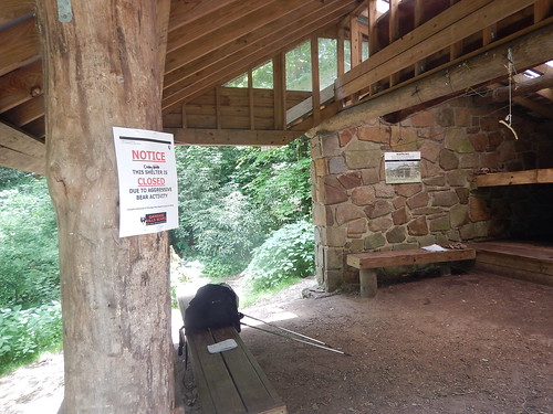
Sure enough, I was on my way for what would turn out to be my last hiking day--- a very long one at 24.3 miles and 15 hours. I left the shelter area at 3:50 am by navigating with my flashlight on moonlight in the early hours and spotting the familiar white blazes on the trees every tenth of a mile or so.

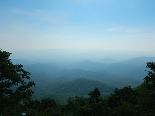
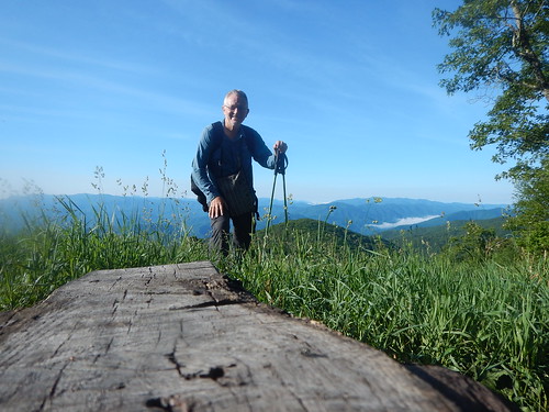
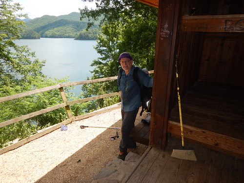
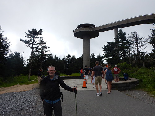
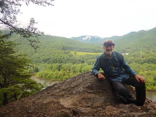
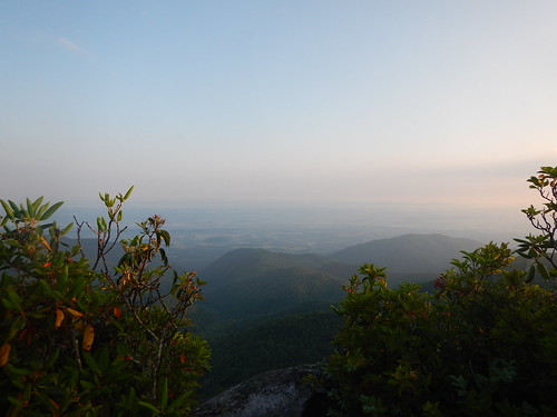
One of the best views of my journey was on top of the Big Firescald Knob----I wonder how that got named---just as at sunrise with the fog dispersing. Here I am with a plaque titled "Howard's Rock" named for a volunteer trail maintenance manager who had improved in developed miles of the AT over a 20 year or more period. A lot of work goes into maintaining the hiking trails throughout the US because the public agencies continue to lack funding for such projects. 

In Washington state where I am from the Washington Trails Association provides that function and they are said to be the largest volunteer organization in the US if not the world to do such work.


Here are some of the difficult trail work that Howard's crew had done around Firescald. Notice the white blazes that mark the AT on some of the rocks.


I have done day trail work along with my daughter as a part of her community service projects, and I continued with two one week backcountry projects: one on Gold Creek trail leading to the Pacific Crest Trail and the other near Deep Lake on the PCT. It takes a lot of work to accomplish some of the trail work, especially in Wilderness Areas where power tools are prohibited.

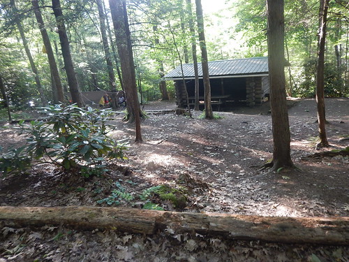
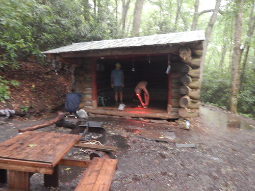
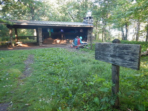
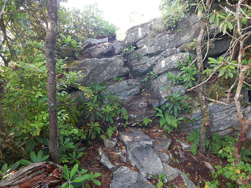
After a tortuous route up and down through the boulders, I headed down to the Jerry Cabin Shelter---300.1 miles---where I crossed the 300-mile mark on the AT, and also met up with a hiker with a trail name of Forgetful. He asked me if I had seen his solar charger on my way to the shelter. I hadn't so he continued up---I understood why he got his trail name. I would later hike with him throughout the day. He was faster than me uphill and I was faster down so we evened each other out as we joined up at the occasional water seeps. I think I have had about 4 to 6 liters of water a day.

I then continued up to the Big Butt Mountain---named because it is bare of trees?---and with the early morning dew, my shoes, pants, and shirt were saturated with water.


At the Devil Fork Gap---308.9 miles--I tried for a short time to hitch a ride to Erwin, TN, but very few cars drove by. Two southbound day hikers came down and I tried to yogi a ride from them, but they were heading south to Asheville instead of Erwin. So my next bailout spot was Sam's Gap--317.6 miles--another 8.7 miles mostly uphill--Ughhh! I thought I could be there by 6pm but ended up arriving at 7pm.

I left Forgetful at the Hogback Ridge Shelter---315.5 miles and made it up some more hills until it was down to Sam's Gap---317.6 miles. That seemed like the longest 2.4 miles I had ever walked. 
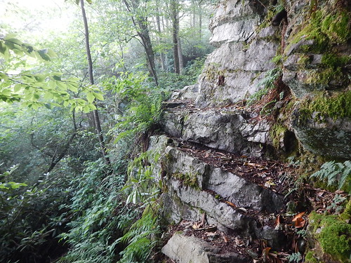
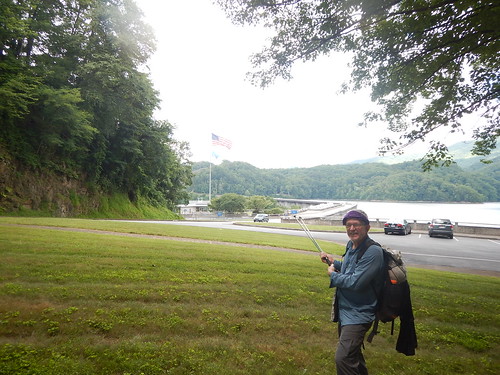
When I saw the I-26 interstate, my thoughts of hitchhiking were dashed because the area was a long bridge spanning two hills with no room for pullovers plus a chain-link fence to dissuade hitchhikers. 

I had two choices: 
1. Continue hiking the remaining 14.5 miles to Erwin and Uncle Johnny's Nolichucky Hostel which would require an overnight stay somewhere along the way. 
 2. Call Uncle Johnny's for a shuttle ride to his hostel. I chose this and was glad of it.

My shuttle driver, Gary Clark, showed up in about 35 minutes and took me on a twisty side road down to the hostel some 15 miles away for $30. Along the way, we spotted three deer and one was a doe with her still spotted gangly fawn. In addition to being my "Uncle Johnny Uber driver", Gary Clark also worked as a raft guide, a snowmaker, and a semiprofessional snowboarder who had won awards all over the east coast until an accident dislocated his shoulder, broke some ribs, and punctured one of his lungs.

Uncle Johnny and his wife lived up to his trail reputation as an easygoing hippie lifestyle complete with a matching tie-dye tee shirt. He had a big Santa beard and preferred to offer cash discounts instead of credit cards. 

Even when I asked to pay by credit card, somehow the machine did not process so I got the discount. They even gave me a free dinner. I was too tired that night to search the Internet for travel back home until after the office closed. I spotted a possible Delta flight from the Tri-Cities, but by the time I rechecked, the opening was gone.


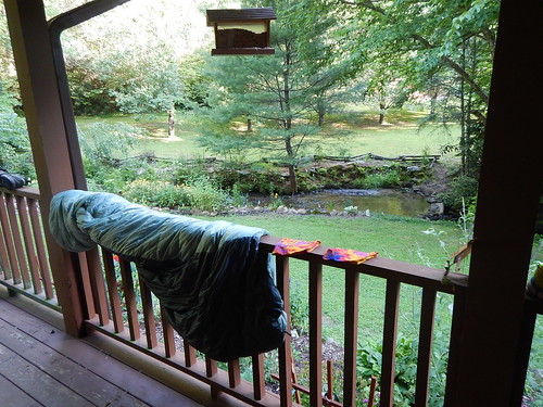
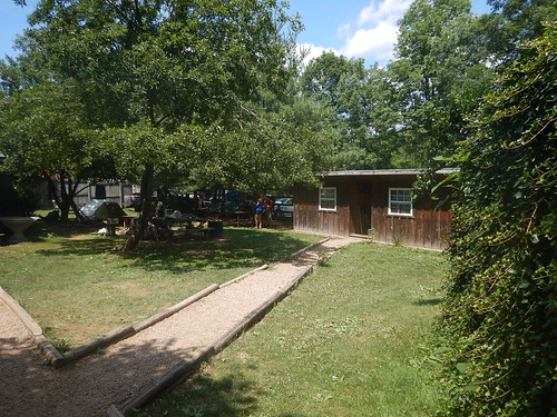
Here is my air-conditioned cabin H to the right--my home for 2 nights.


June 26, 2016
My plans to take the Amtrak were eliminated because there was no nearby Amtrak plus the planned trip from Washington, DC to Seattle at $197 was no longer available. The current price was now $714 plus another $120 Greyhound bus ride to get to Washington, DC. On the other hand, a Delta flight was $576 or 32,500 miles. I picked the airline mode of travel for Monday.

After talking with Uncle Johnny, I decided it would be better to stay at his hostel another night rather than going to a hotel near the Tri-Cities airport. He would have a shuttle driver take me there tomorrow by 9--9:30am---a small airport with no long security lines he said for about $60. Plus, I still have my private room with Netflix and Kumo for entertainment if the other hikers aren't entertaining enough.

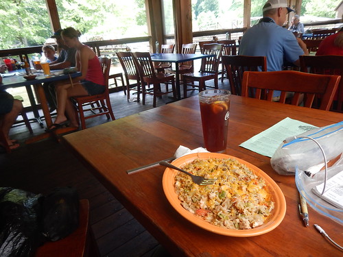
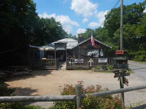
They offer free shuttles into Erwin town for breakfast and dinner so, at the Huddle House, I had a traditional southern breakfast of eggs, hash potatoes, toast, coffee, and chicken fried steak with pepper gravy. Locals say you can patch holes in walls with some of this gravy. 

Everything was good. I am looking forward to dinner in town with the other hikers---my last southern dinner---green beans with the life cooked out of them, fried chicken or ribs, pickled cucumbers, fried green tomatoes or okra, etc.


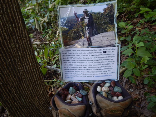
My final AT activity was to take some pictures where I ended up with the green rock I have been carrying in memory of BamaHiker who had planned to hike the entire AT but died of cancer in 2015.

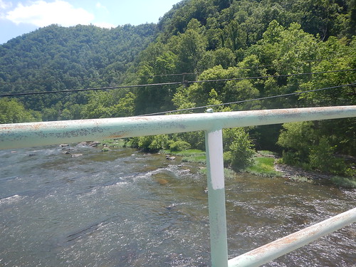
His spouse asked hikers to pick out a pebble and take a picture of it wherever your hike ended. So here it is right on the AT trail that crosses the Nolichucky River by Uncle Johnny's Nolichucky Hostel. I am sure that BamaHiker would have enjoyed the warmth and helpfulness of Uncle Johnny, his wife, and other AT hikers passing through this hostel.

Here is BamaHiker's green rock just above the white blaze of the AT trail as it crosses the Nolichucky River just across from Uncle Johnny's place.


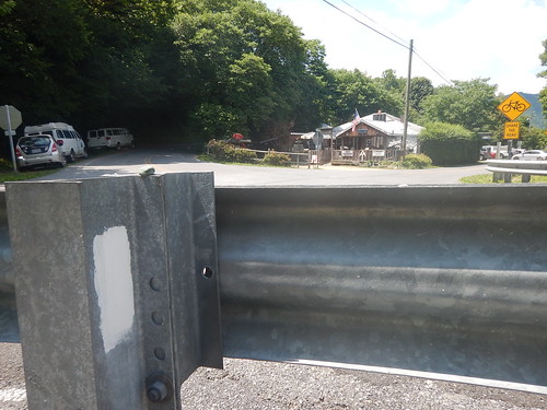
BamaHiker's Rock on top of the road railing looking toward Johnny's hostel.


HYOH---Hike Your Own HIke----and that is what both Gary and I have done as with life.

Thursday, June 23, 2016

Newfound Gap to Hot Springs---207 to 274 miles---Summer 2016

June 20, 2016
I slept in until 7:30am and had the hotel breakfast of raisin bran, OJ, bagel with cream cheese, and jam with frequent cups of coffee. I caught up with my AT adventures on this blog before I headed out for the hitch up to Newfound Gap some 15 miles east.

I walked to the edge of town right across from the NOC outfitters shop where I had gotten a resupply the night before with Kaley and Richard. I started hitching at about 10:45am and got a ride within 15 minutes.


Bless the trail Angels. Lloyd and Maria were just returning to Georgia after delivering about 3/4 tons of honey to several of the retailers in Gatlinburg. They said they packaged some with the retailers' labels and some with theirs.


Lloyd said that he and Maria first met over an Internet dating site about 12 years ago and have been married for the past 10 years. She is a retired meteorologist from Mexico City and will soon take her US Citizenship test to become an American citizen.

Lloyd had grown up around this area and had hiked a lot of the Appalachians including a lot of portions of the AT. As far as the beekeeping business, he has about 1,000 colonies of bees and each colony has 30,000 bees. His colonies are stationary at various farms and he has several types of honey-based on what type of plants the bees are located in ranging from cotton, fireweed, melon, berry, and so on. Since the bees are dormant during December and January, they use that time to travel usually to Mexico City to visit Maria's relatives.

Here they are at the Newfound Gap parking area after getting me there with a short pause for me to photograph a wild turkey alongside the road.

I started up the AT at about 11:45 at milepost 207.1. There were more day hikers both heading out and returning on this trail than I had ever seen before. Almost all of them went to visit the Charles Bunion viewpoint some 4 miles from Newfound Gap.

While walking I found a young guy was keeping pace with me so we talked along the way. After graduating from college, Quincy became a general aviation flight instructor with both single-engine and twin-engine airplanes both VFR and instrument-rated. One of his most exciting flight adventures occurred in the Moab, Utah area. He had just dropped off four skydivers from his Cessna and was returning to the airport when his engine went out. He was at just 1,500 feet and barely had time to locate an emergency landing spot. He successfully landed the plane without crashing, the right wheel support came off and slashed a bit of the side of the airplane as well as the right aileron. He had no injuries and they were able to repair the plane. Apparently, the accident results are still pending with the NTSB. He said that in landing the plane, his training just kicked in, and his actions to land the plane as he did play out as planned. He is hoping someday to fly commercial planes instead of staying as a flight instructor. When I learned how to fly Cessna 150s and 172s I remembered that most of my flight instructors were young like him and wanted to become commercial pilots as well.


Before we knew it we had come the four miles to the Bunion viewpoint---the big rock outcropping looks like a big bunion as well. At that point, I left Quincy and the crowds behind. I would hike the rest of the day without seeing any other hikers until I got to my Pecks Corner Shelter---217.3 miles.


Along this way, there were several views as I walked along this knifepoint ridge to the shelter. Lots of Rhodhedrons in bloom along the way and even carpeted the path with pink petals.


I shared the shelter with a family of three, Alicia and Charles the parents, and their son August. Alicia was now a personal trainer after having been a supervisory social worker at a hospital----I am sure there was a story there.


Two women who had just graduated from college. Krista was going on to Vet school and Bethany wasn't sure, but for now, she continued working at a bakery.

Jordan was a math and music teacher from Potomac, MD, and was busy lightening his load by sorting out some unwanted food items from his gorp. Alicia was giving Jordan lots of nutrition advice hence the sorting out of the gorp.

Apparently, bears were a big problem so we all put not just our food bags but also our backpacks up in the bear cables provided by the NPS.

June 21, 2016
Summer Solstice! I got a 6:30 AM start while most were still asleep since I wanted to get to Davenport Gap and stay at the Standing Bear hostel----240.6 miles---a 23.3-mile day. I thought this was doable since most of the way would be downhill--from a high of 6,300 feet to a low of 1,700 feet.


There were lots of views as I made my way along with this recently well-maintained trail that was on a knife-edged ridge with some great views that shortly became obscured by fog and clouds.


I stopped for lunch at the Cosby Knob Shelter---229.9 miles---which was closed because of high bear activity---for lunch, water, and massage my feet.


After that, it was one last hill to climb, Mt. Cammerer---just 700 ft up, and the rest would be down from 4,950 down to 1,700 feet.

Near the bottom, the trail widened out and then plunged down alongside a creek after leaving the Great Smoky National Park. The trail emerged at a road bridge across the Pigeon River---239.5. I missed the AT trail that headed up to the Standing Bear hostel and instead did the road walk and was glad to get there about 6:25.

The place looks like a set from the Knotts Berry Farm with a bunkhouse, a general store where you buy resupply things on the honor system including do it your self dinners---I picked a Digiornios Supreme pizza washed down with Mountain Dew. I first showered, washed my stinky clothes, and put them in a dryer before chomping down on the pizza.


Just like Hotel California, some hikers never leave---here are their shoes.


I was entertained by a musician---trail name Trubador, along with others playing a washtub cello, and a 5-gallon bucket as a drum while eating my pizza.

I also met up with Janine who shared a shelter with me back on June 18th. She had to hike through the Smoky NP because dogs aren't allowed on the trail and she is looking forward to reuniting with him at Hot Springs where she had him shuttled.

Loud claps of thunder and lightning followed by rain ended the night here as we all shuffled to our bunkhouse.

June 22, 2016
I got a late start---8:40am--on the first climb out of the day of about 2,500 feet to Snowbird Mountain that was "bald"----just grasses grow on balds----except for an FAA VOR humming along providing navigation service to airplanes. It was good to have some views of the surrounding area instead of just the "green tunnel".


On the way up, I passed most of the hikers who had stayed at the Standing Bear hostel including Trubador who entertained us with some jazz guitar music, and Further Father---a Catholic priest from Italy.

Four of the springs I was planning to get water at were dry and I was hoping that the water at Brown Gap---250.4 miles--was running. Just as I arrived a hiker in a blue shirt emerged from the campsite where the water was supposed to be. He said it was but, barely. He said his trail name was "Bald Eagle" and I would catch up with him later at the Max Patch summit---another bald at 254 miles.


I met him there along with a crew of three who were waiting for the light to be just right to do a photoshoot of a beard product commercial. They thanked me for volunteering, but just a red beard was needed and not a grey beard.

I pulled into the Roaring Fork Shelter---255.7 miles---at 7pm and there were just 4 women who had hammocked up next to the shelter. Bald Eagle joined me in the shelter as did Janine and Blue Auditor about 2 hours later. Soon it was bedtime as darkness fell.


June 23, 2016
I woke up early so I headed out just about 6am the dawn for what would be a mostly downhill hike to Hot Springs, NC---one time retreat for FDR. There was lots of water available along the way and the tread was good so I arrived at Hot Springs---273.7 miles---at 2:40pm.

After a welcome shower, I gave all my dirty clothes to the manager, Greg, for washing while I put on some loaner clothes and headed to the Hot Springs Resort and Spa for an hour soak in the mineral waters and a half-hour massage. How relaxing. After that, I ate at the Spring Creek Tavern with a local band performing. Stopped at the Dollar Store for resupplies and then it was back to the Hostel at Laughing Heart for organizing and sleep.


Monday, June 20, 2016

Dicks Creek Gap to Newfound Gap 69.6 to 207.1 miles---Summer 2016


Dicks Creek Gap June 12, 2016
I left Gary and the Top of Georgia Hostel at 7:30am on Sunday, June 12th. From the Hostel it was just a half-mile hike up the highway to the AT. Of course, everything was uphill from the Dicks Gap.


After about three more ups and downs through the "green tunnel", I reached the Georgia/North Carolina border about noon----78.5 miles. Just past the border I came across this Bly Gap gnarled tree often photographed By now, I met up with few other hikers going either north or south.


I showed up at the Carter Gap Shelter----93.9 miles, where two middle-aged guys were finishing up supper as it was beginning to darken. Mike was a Triple Crowner having hike the Pacific Crest Trail, the Continental Divide Trail, and The Appalachian Trail. His hiking buddy had just retired and was living out his dream. I quickly decided to spend my first night inside one of the shelters found along the AT since I didn't want to bother with putting up my tent.

June 13, 2016
Occasionally I would hike through big groves of Rhodhedrons. The highlight of the day was my climb up the 40 ft historic fire tower where I could finally get some fabulous views of the Appalachians.


I made my way up and down to the Winding Stair Gap---109.8 miles.

I got there about 3:30 pm and began hitchhiking to Franklin, NC some 10 miles east of the gap. Within 1/2 hour I got a ride from a family who had been attending the "Rainbow Festival or Gathering". Apparently, it is a gathering of hill commune people, musicians, artists, and the like. They picked me up because they thought I was a mountain man---see what a few days in the woods do.

The mother had Rastafarian dreadlocks and she was covered by several tattoos and was lighting up a hand-rolled cigarette. The driver had a raggedy cowboy hat, scruffy beard, and a beat-up jeans vest. In the back instead of seats there was a hammock that the oldest girl laid in and the younger one was under the hammock. Both had pretty face paint designs. Behind me was a big white dog guarding his bag of food. I sat in the wool-lined swing that the little girl had given up for me. They dropped me off near the Outdoor Supply store so I could get some resupplies, and waved them thanks and goodbye.


I stayed at the Microtel Hotel for $60 which included breakfast and a listing of trail angels who would give AT hikers a lift back up to the Winding Stair Gap. I called and Kay offered to pick me up at the hotel at 7am just after their free breakfast. I then had a big dinner of ribs, chicken and shrimp washed down with sweet tea and finished off with peach cobbler.

June 14, 2016
Just as I finished breakfast at the hotel at 7am, Kay showed up for my ride to the Winding Stair Gap. I tried to give her a donation for either herself or her Natahalla HIking Club, but she said she could not because their club had not paid for a $100 permit to the US Forest Service.

Here is one of the few creeks I have come across.


Again it was mostly up to some rare views of the territory including a visit to the Wayah Bald Tower that honors the first Forest Supervisor who constructed the original tower.


By now, the rain was soon to arrive based on the thunder and lightning that had just started just as I arrived at the Cold Springs Shelter----125.6 miles. Two hikers were just finishing dinner and starting a Bonfire. Two more guys showed up who I had earlier met were researchers of the water seeps along the AT. The research assistant quickly put up his hammock along with a blue rain tarp, The other one said he would wait to see where the rain did not puddle. He would then put his tent right on the AT trail.


We continued to enjoy the dry shelter as the fire the two guys had made began to sputter during the downpour. Once it was dark we all fell asleep.

June 15, 2016
This would be my first day hiking in the rain, so I started out with my rain jacket and bright yellow frog togs. My feet quickly got soaked from the rivers running down the trail and it was like a sauna wearing the rain gear. At least the stuff in my backpack was all protected from the rain by ziplock bags and other plastic bags.


By noon the rain had stopped.

Shortly after that, I got down to the Nantahala Outdoor Center at the intersection of US 19 b& 74----137.3 miles. This was a water sport Mecca with rafting and kayaking. I had a big Sherpa rice, a chicken dish with bottomless sweet tea before heading back on the trail.


As I headed across the AT River bridge and up the hill it again began to rain as I made my way to the next shelter at Sassafras Gap---144.0 miles. There were four college kids already set up and had eaten, I noticed that one of them always felt the need to talk----his trail name was Songbird, but if it was up to me, I would have named him Motor Mouth. I cooked my dinner, washed my shirt and bandana, and got in bed to see that part of my bag was soggy---better double bag next time. Darkness won out and all were asleep shortly.

I had to get up during the night to pee and as I wandered over to the bushes with my little flashlight I saw another light just 20 feet away. It was not another hiker but a firefly---then I saw more.

June 16, 2016
After a short climb from the shelter, I came to the Cheoah Bald---these are mountain tops characterized by grasses rather than trees though that is changing with encroaching azaleas and other bushes. More great views. I decided to try out the Creekside Paradise on the AT Lodging-Camping rather than another shelter. I called them to arrange a meeting at the Yellow Creek Gap---158.4 miles--which was about 2 miles from their place.


Cynthia picked me up near the fish hatchery as I was walking down the road and when I got there there was only one other hiker there---Manimal from Brooklyn. He was heading southbound and was a musician, pizza maker, and bartender when he was not hiking the trail.

The room was one of four they rented out in this beautifully finished off log building. I quickly gave them my dirty clothes which they washed and dried as part of the $60 charge and I got my swimsuit on to join Manimal in the wonderfully jetted hot tub. It felt really good on my aching muscles and feet. The home was set on a 20-acre spread with a rushing creek nearby along with four hound dogs---Jeff and Cynthia's kids---two big motorbikes they enjoyed cruising through the windy roads in the area.


I paid an extra $15 for a wonderful dinner of a thick steak, baked potato, and grilled vegetables along with lemonade and sweet tea. Since their wifi was satellite-based, Jeff asked us to restrict our usage to just emails and not file uploads or downloads.

June 17, 2016
The breakfast spread covered by the lodging costs was outstanding with lox, cream cheese, and bagels along with cereal, juice, fruits including my favorite--watermelon, and designer coffee.


They drove me up to resume my AT hike toward Fontana Dam and beyond about 7:30 am.


The Tennessee Valley Authority Fontana Dam was quickly built at the direction of President Roosevelt during WWII to provide electricity to support the war effort in airplane manufacturing----about 50,000 planes relied on this power to be built. I don't think with the state of the divisiveness of Congress and Executive Branch this project or the related Civilian Conservation Corps that built much of the AT trails, shelters, and fire towers would be built in our time.

Near the Fontana Lake boat launch area, I found this memorial of shoes filled with pebbles from the widow of the man who had planned to hike the AT, but died of cancer the year before he was to start. Her simple request was for us hikers to take a pebble with us and then take a picture of where our journey ended and send it to her. I picked a green one and hope to take a picture of it with Harper's Ferry in the background.


Here is a picture of the "Hilton" of AT shelters that overlook Fontana Lake---165.9 mi. It is large, has showers, and even a solar charging station along with a water pump instead of the more common seeps and streams normally found.


At this point after crossing the Dam---166.3 miles, I entered the Great Smoky National Park and deposited my permit in a slot box.


Shortly the AT straddles the Tennessee/ North Carolina borders for the remainder of the hike through the Smokies.

On the way to my shelter, I took a brief pause on my throne of rocks--169.4 miles.


After that, I climbed up the Shuckstack fire tower for some rare views of the Smokies.


I arrived at the Mollies Ridge Shelter just before dark where four women were in the upper sleeping loft already in their sleeping bags. They told me where the water was---about 70 yards down a path.

When I got there, I briefly saw my first black bear also drinking in the spring. He ran away before I either got my camera out or I could run away. I then washed up and cleaned my shirt and bandana before heading back up to the shelter for a quick dinner and then sleep.


June 18, 2016
I was the first to head out at about 7:30am and passed the next two shelters that were closed because of high bear activity there.


When I got to the Rocky Top and Thunderhead views area, Sara and Dominic from the shelter caught up with me and we stopped for lunch at one of the Rocky Tops. Sara, in the pink, is a pedicab driver in New Orleans and Dominic, in the blue, is working in genetics after getting her Ph.D. in fruit flies. She is originally from Poland but now lives in Scotland. They met at a yoga retreat in Costa Rica and again met up to hike some of the AT. They were very strong hikers.


We finally had some great views from these mountain tops as we made our way to the next shelter called Derrick Knob Shelter. I had planned to stay there when a large group of REI Expedition hikers showed up at their "reserved" shelter. This meant that as a thru-hiker we had a choice of camping in our tents and enjoy the good cheer of the REI group to celebrate their last night on the trail.

Sara and Dominic decided to camp while I decided to press on another long 5.7 miles to the Silers Bald Shelter---195.0 miles. This shelter had 12 sleeping slots and all but two of us had reservations. Fortunately, no one else with reservations showed up so I got to stay in the shelter.


June 19, 2016
I got a 6:30 AM start since I wanted to get into Gatlinburg earlier to clean up, resupply, eat, and sleep comfortably in a hotel. But first I had to climb up to Clingman's Dome which is the highest point on the AT at 6,667 ft. There was quite a transition in plant life from the common deciduous plants and trees to evergreen hemlocks, pines, and firs which reminded me of the Northwest woods I am most familiar with. Along the way, a deer crossed my trail.


I finally emerged at Clingman's Dome---199.5 miles and enjoyed what scenery I could with the clouds swirling by. There I met Andrew and Susana who were most interested in what kind of gear I used while hiking. He was wearing the same shoes as me and expressed interest in trying some long-distance hiking. They took some pictures of me and we're going to email them to me.


After leaving Clingman's Dome, I was hoping it would be all downhill, but Mt. Collins made it for another up and down before I emerged at Newfound Gap---207.1 miles. The place was filled with tourists and I got one to take me a picture by the Tennessee/ North Carolina border sign.


It took me about a half-hour before I got a hitch down to Gatlinburg about 15 miles West of the gap. A father-daughter couple who had just finished hiking a portion of the AT for Father's Day picked me up. Kayley and Richard not only drove me to my Microtel hotel but before that, we stopped at a popular outfitter---NOC---where I got a couple of resupply food items.

Gatlinburg looks like the hillbilly capital of the world with Dollywood, Paula Deen Restaurants, Ripley's Believe it or Not, and Hatfield and McCoy Dinner feud among other things. I had dinner at a local BBQ place and was served up waaay too much beef brisket, fried green tomatoes, Coleslaw, and potato salad. At least I did not try one of the all you can eat places.


I got a wonderful Father's Day message from my daughter, Jessica, who recounted some of our shared experiences and what it meant to her along with my grandson's "Diaper Dance" video. Both brought tears and joy to me.